Black and White
Westbound Along Grassy Trail Creek {more...}
Detail, Buried Forest Concretions {more...}
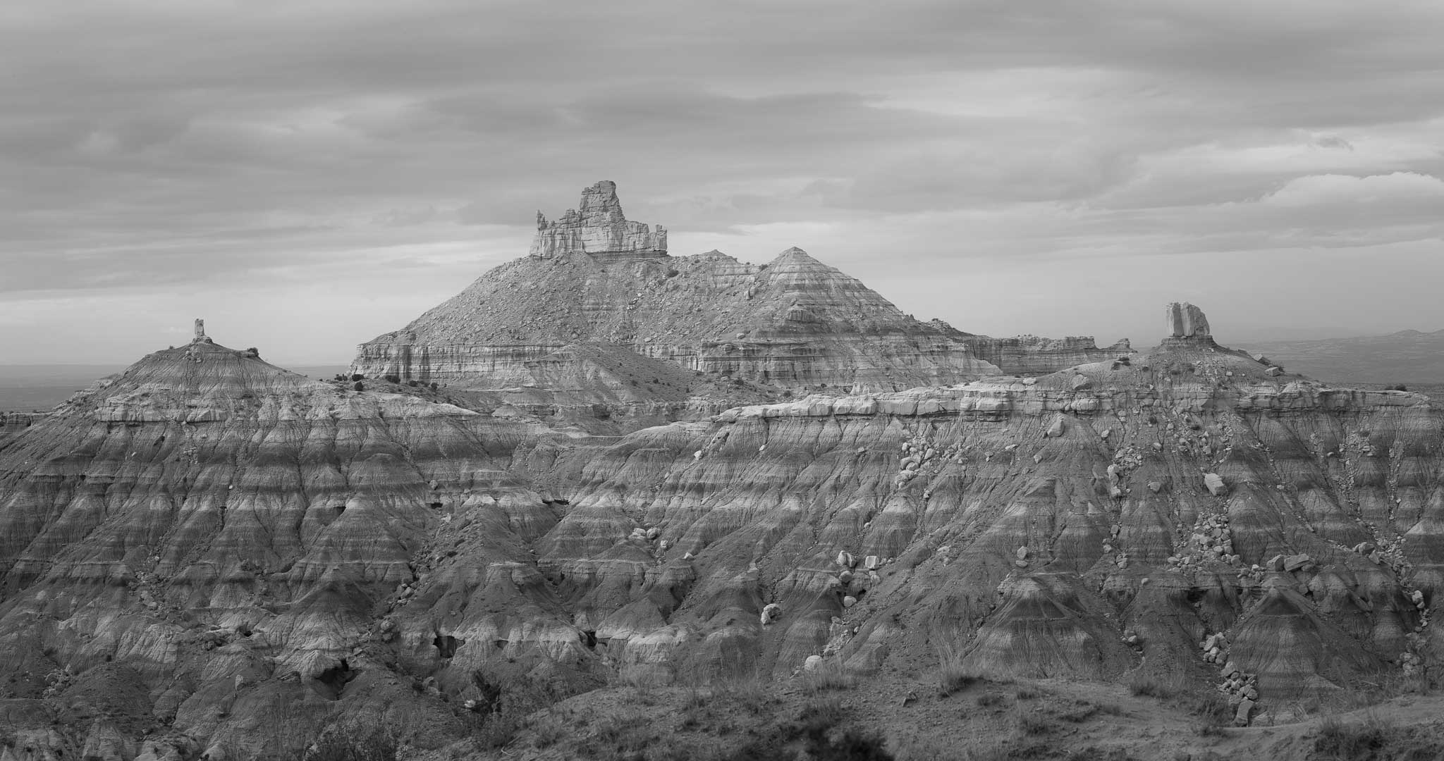
Rudolph and Santa Claus Butte, Valley of the Gods {more...}
Dinosaur {more...}
Snow at the Roost {more...}
Daybreak {more...}
Dawn's Early Light {more...}
Guardian Angels {more...}

Hangout {more...}
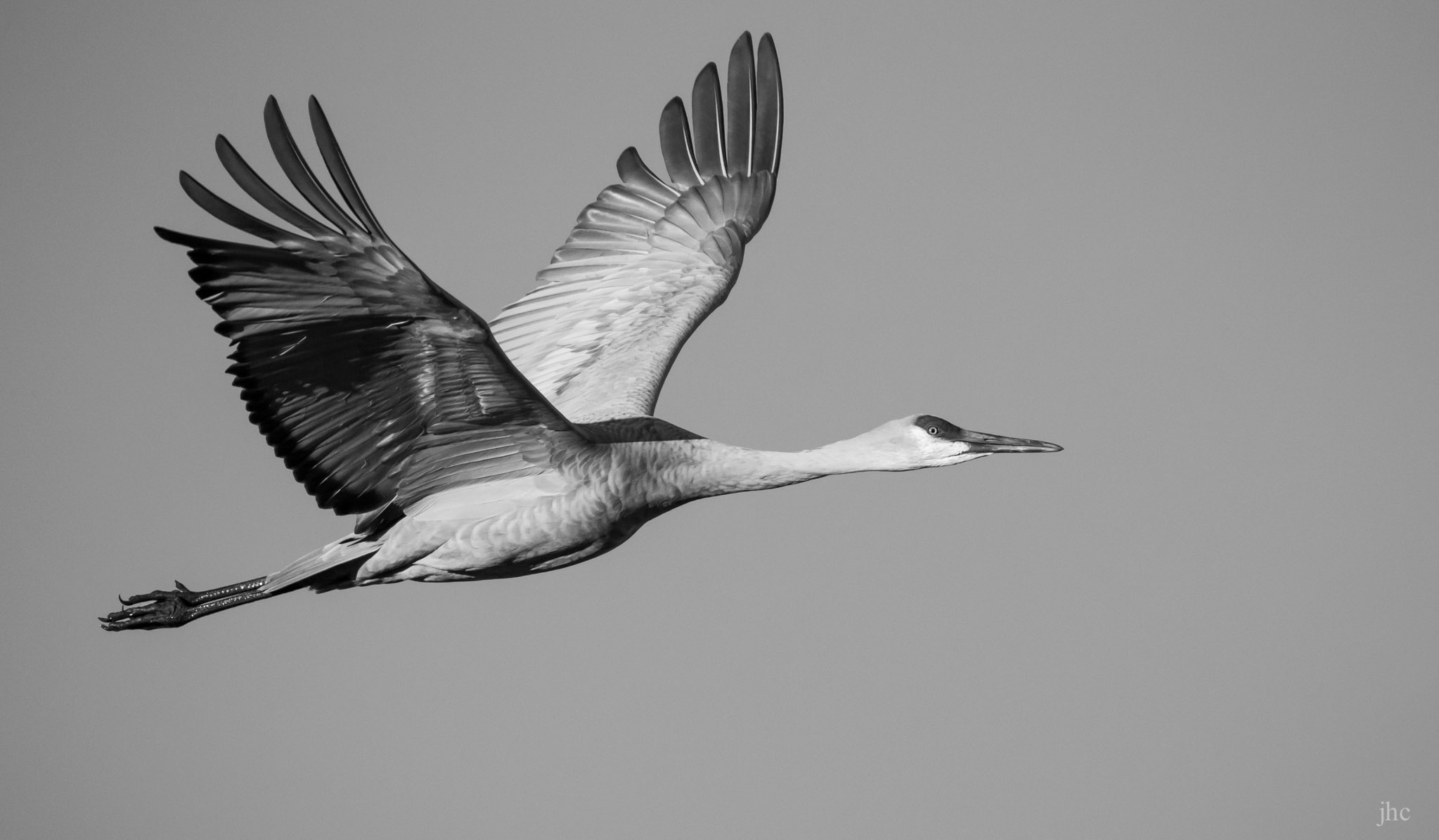
Sandhill Crane, A Portrait in Flight {more...}
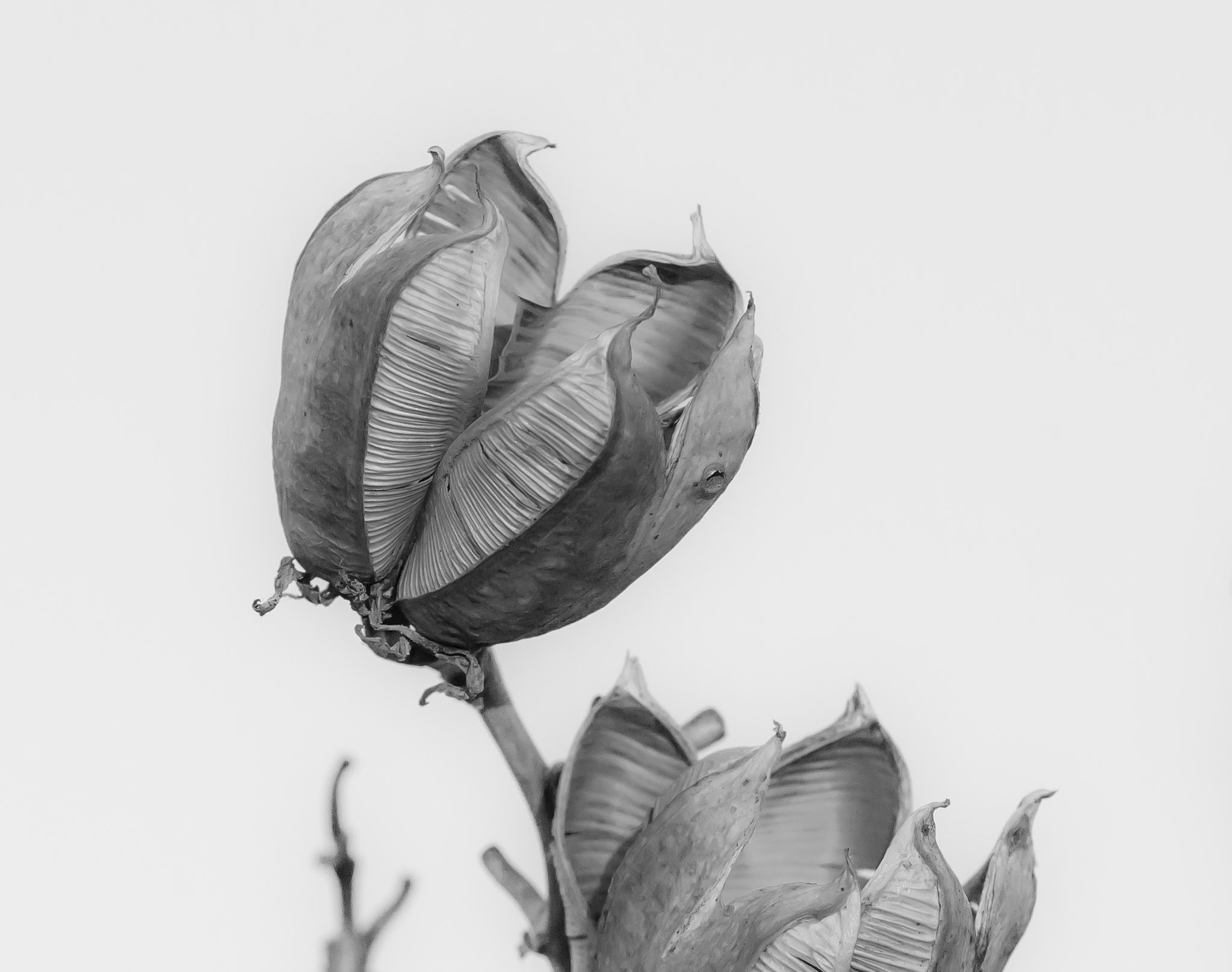
Mission Accomplished {more...}
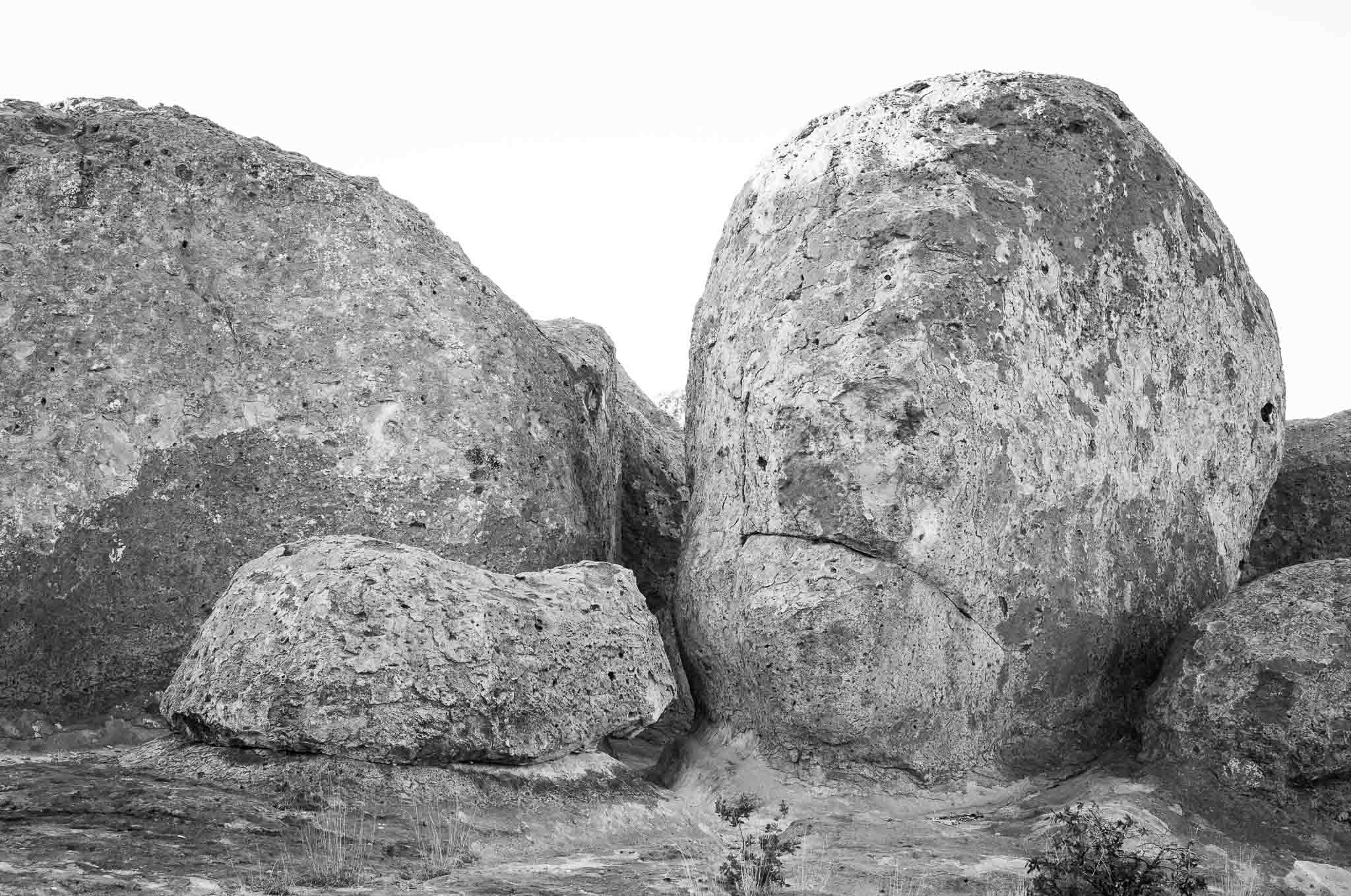
Eeeeew! {more...}
Horsefeathers {more...}
Shadowed {more...}
Ocotillo Moonrise {more...}
Addenda to Photos
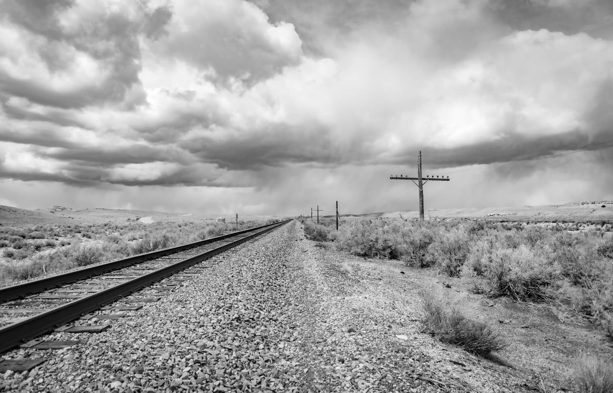
Westbound Along Grassy Trail Creek
Price River Road, Wellington UT
April 24, 2022
Grassy Trail Creek is a largely ephemeral tributary of the Price River near Wellington UT. Here the Chicago to San Francisco mainline passes along the creek.
The Price River
The Price River is a 137-mile-long (220 km) southeastward flowing river in Carbon, Utah and Emery counties in eastern Utah. It is tributary to the Green River, itself a tributary to the Colorado River.
The river's early name was the White River, but it was changed in the summer of 1869 when LDS Bishop William Price of Goshen, Utah, explored the region and renamed it, making the White River above Colton into a tributary of the Price River. The town of Price was later named after the river.
Wikipedia: Price RiverWellington UT
Wellington is a city in Carbon County, Utah, United States. The population was 1,676 at the 2010 census. The community was settled in 1878 by a band of thirteen Mormons led by Jefferson Tidwell. The town was named for Justus Wellington Seeley, Jr., of the Emery County Court. Many residents commute to nearby Price for their jobs, or work in one of the various coal mines in the area.
Wellington is located southwest of the center of Carbon County at 39°32′22″N 110°43′47″W (39.539476, -110.729667), along U.S. routes 6/191, which leads northwest 6 miles (10 km) to Price, the county seat, and southeast 57 miles (92 km) to Green River.
According to the United States Census Bureau, the city has a total area of 5.1 square miles (13.3 km2), all land. It is just north of the Price River, a southeast-flowing tributary of the Green River.
Wikipedia: Wellington Utah
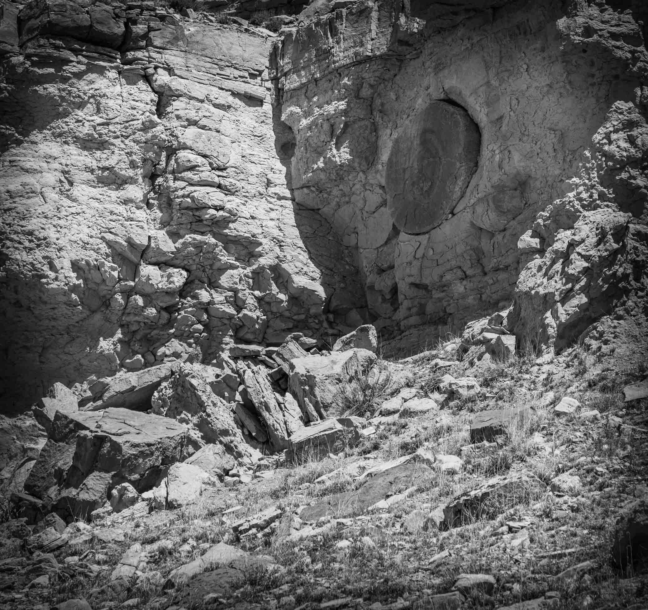
Detail, Buried Forest Concretions
Near Grassy Trail Creek, Wellington UT
April 25, 2022
A detail of one of the many interesting concretions embedded along this cliff face. It's about a mile hike in from the parking lot to the cliff face on a fairly easy trail, and is well worth the effort to see this odd bit of geology.

Buried Forest Concretions
Cannonball Concretions in a Treeless “Buried Forest,” Carbon County, Utah
Near the start of the 20th century, a Utah photographer captured an image he labeled “Buried Forest,” perhaps thinking multiple large circular objects exposed in the cliff face were petrified logs (spoiler alert, they were not). Recently, rediscovery of the “Buried Forest” concretions came at the right time to give folks in Carbon County a distraction from COVID-19 confinement. Price, Utah, resident Scott Wheeler’s curiosity to find the location of an old black-and-white photo and his desire to share the historic and geologic find with others led to its eventual designation by the U.S. Bureau of Land Management (BLM) as an interpretive site.
The photo, taken circa 1899, shows large spheres of rock up to 8 feet in diameter embedded in a cliff that photographer George Edward Anderson had deemed the “Buried Forest.” Anderson identified the location as Sunnyside, which we know today as a town at the base of the Book Cliffs. After months of work, Scott, with the help of Google Earth and friend Alan Peterson, found the cliff 10 miles to the southwest in the Mounds area above Grassy Trail Creek, a tributary to the Price River. Discovering that Mounds had been called Sunnyside in the 1800s, they were able to hone in on the correct location.
Cannonball Concretions in a Treeless “Buried Forest,” Carbon County, Utah by Pete KilbourneConcretion
A concretion is a hard, compact mass of matter formed by the precipitation of mineral cement within the spaces between particles, and is found in sedimentary rock or soil. Concretions are often ovoid or spherical in shape, although irregular shapes also occur. The word 'concretion' is derived from the Latin concretio "(act of) compacting, condensing, congealing, uniting", itself from con meaning 'together' and crescere meaning "to grow". Concretions form within layers of sedimentary strata that have already been deposited. They usually form early in the burial history of the sediment, before the rest of the sediment is hardened into rock. This concretionary cement often makes the concretion harder and more resistant to weathering than the host stratum.
There is an important distinction to draw between concretions and nodules. Concretions are formed from mineral precipitation around some kind of nucleus while a nodule is a replacement body.
Descriptions dating from the 18th century attest to the fact that concretions have long been regarded as geological curiosities. Because of the variety of unusual shapes, sizes and compositions, concretions have been interpreted to be dinosaur eggs, animal and plant fossils (called pseudofossils), extraterrestrial debris or human artifacts.
Wikipedia: Concretion
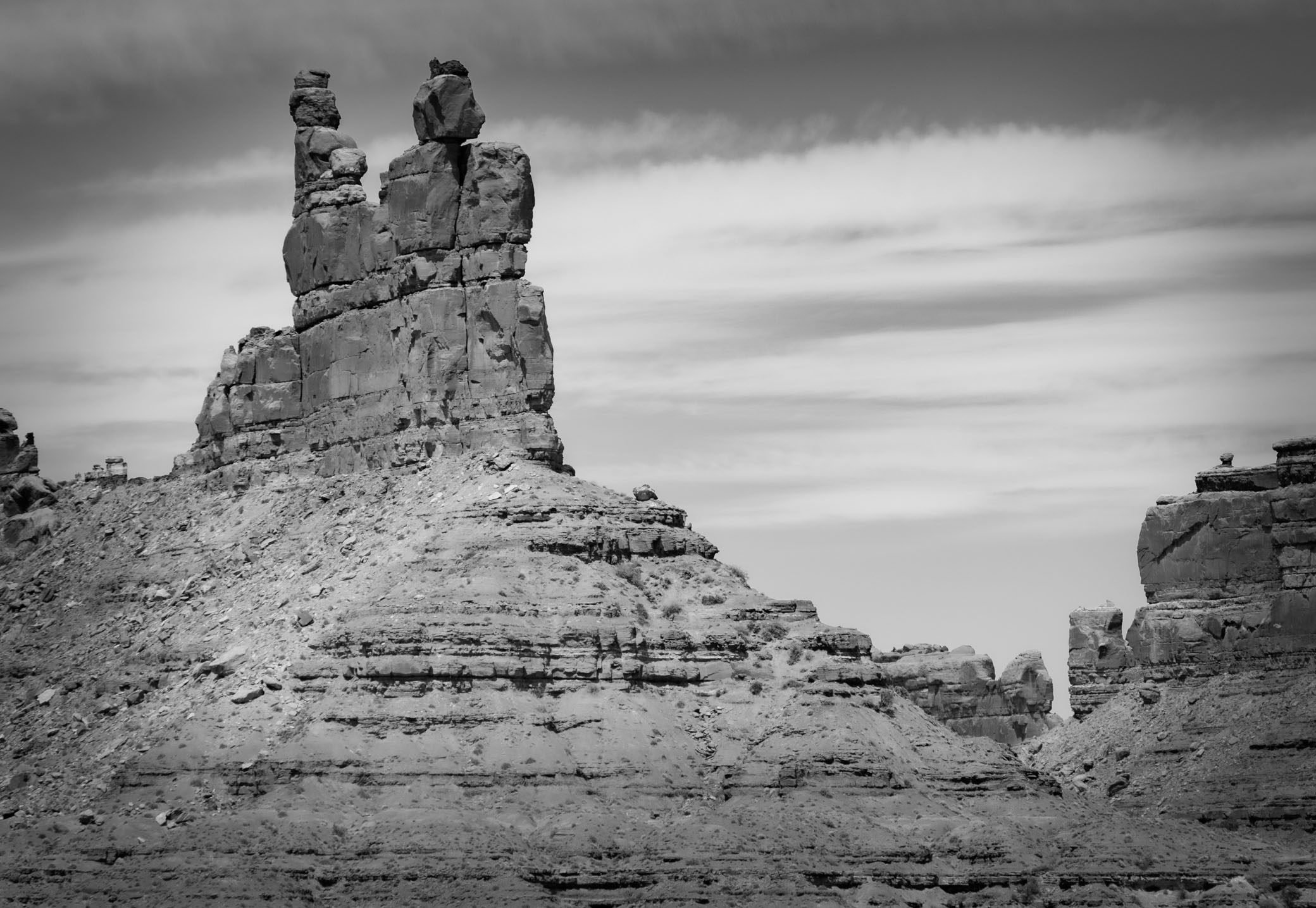
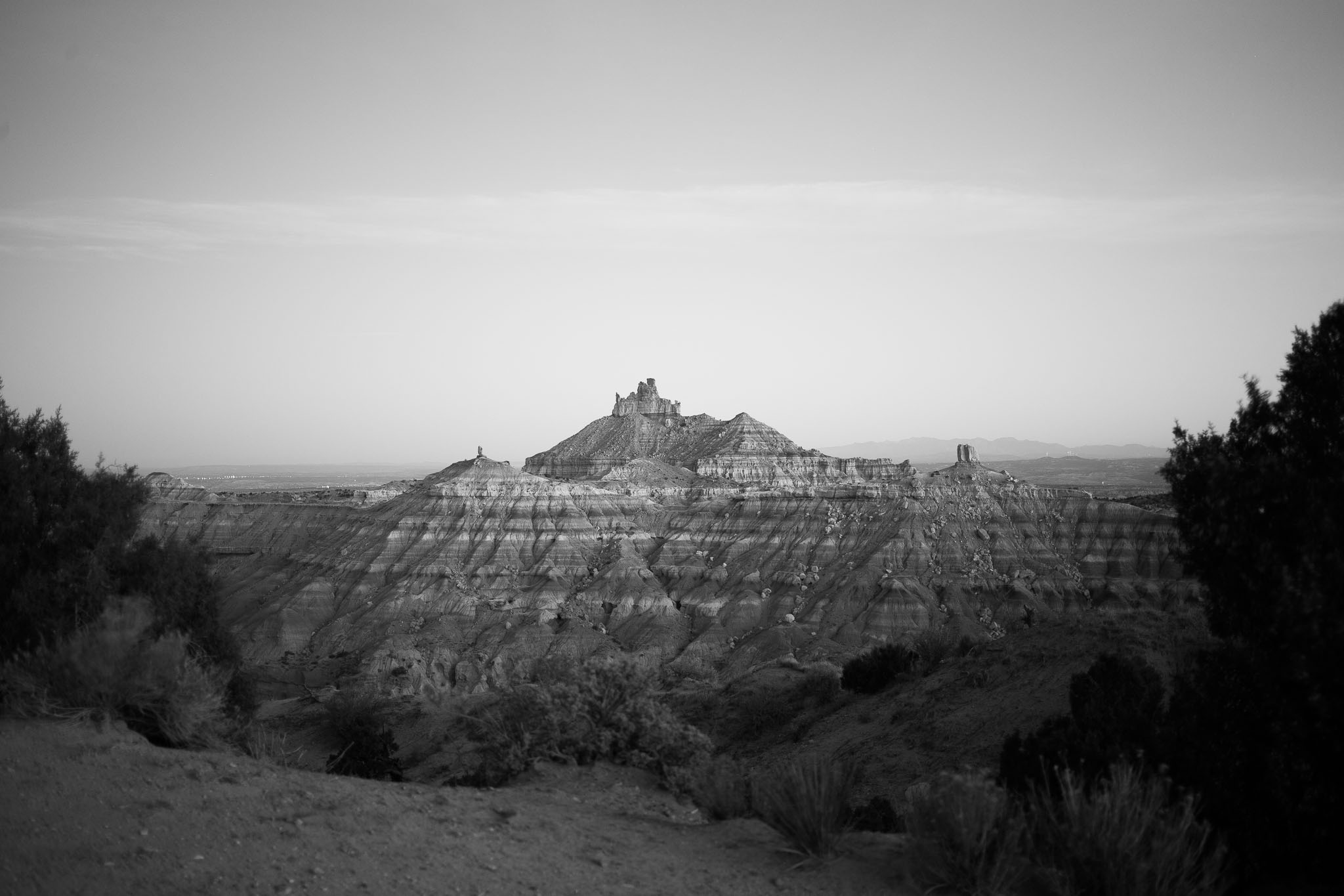
Rudolph and Santa Claus Butte, Valley of the Gods
Mexican Hat UT
April 15, 2022
The butte to the left is called Rudolph and Santa Claus and looks very much like them from the other side. From here I see a native couple with neat hats. Pareidolia is such fun.
Valley of the Gods
You might ask yourself, “What is Valley of the Gods”? Valley of the Gods is a scenic, sandstone valley with absolutely stunning geologic formations. It is located approximately 15 miles southwest of Bluff and about 35 miles from Monument Valley (see directions below). Valley of the Gods is now part of Bears Ears National Monument.
Visitors will find many scenic locations to stop and explore this special landscape. With nearby Monument Valley taking first prize for fame, visitors will encounter fewer tourists while meandering through Valley of the Gods and can enjoy a more personal experience. Permits are not required and there are no fees to drive Valley of the Gods unlike Monument Valley.
Locals have given the rock formations in Valley of the Gods names such as Rooster Butte, Setting Hen Butte, and Balanced Rock/Lady in a Tub. As you drive through Valley of the Gods, think about names you would give to these formations.
Geology
This geological masterpiece, though a quarter of the size of its celebrated neighbor, Monument Valley, boasts a royalty of rich colors and fantastic formations, and is quite stunning. The formations are sculpted from Cedar Mesa sandstone dating to the Permian period, around 250 million years ago.
Valley of the Gods sits at the base of Cedar Mesa. Rocks were deposited by the shallow sea that covered this area about 250 million years ago. After the water receded, the iron in the rocks mixed with oxygen to form rust. This resulted in the rich red and purple colors. Eroded by water, wind, and ice over millions of years, the rock was carved into the unique buttes, monoliths (single massive stone or rock), pinnacles and other geological features as seen today.
The Valley of the Gods is truly a geological masterpiece, rightfully earning its reputation as “a photographer’s paradise.”
The valley is public land managed by the Bureau of Land Management. There are no entrance fees and no services of any kind in the valley. Dispersed camping is permitted at previously disturbed sites, though campfires are not allowed.
Bluff Utah
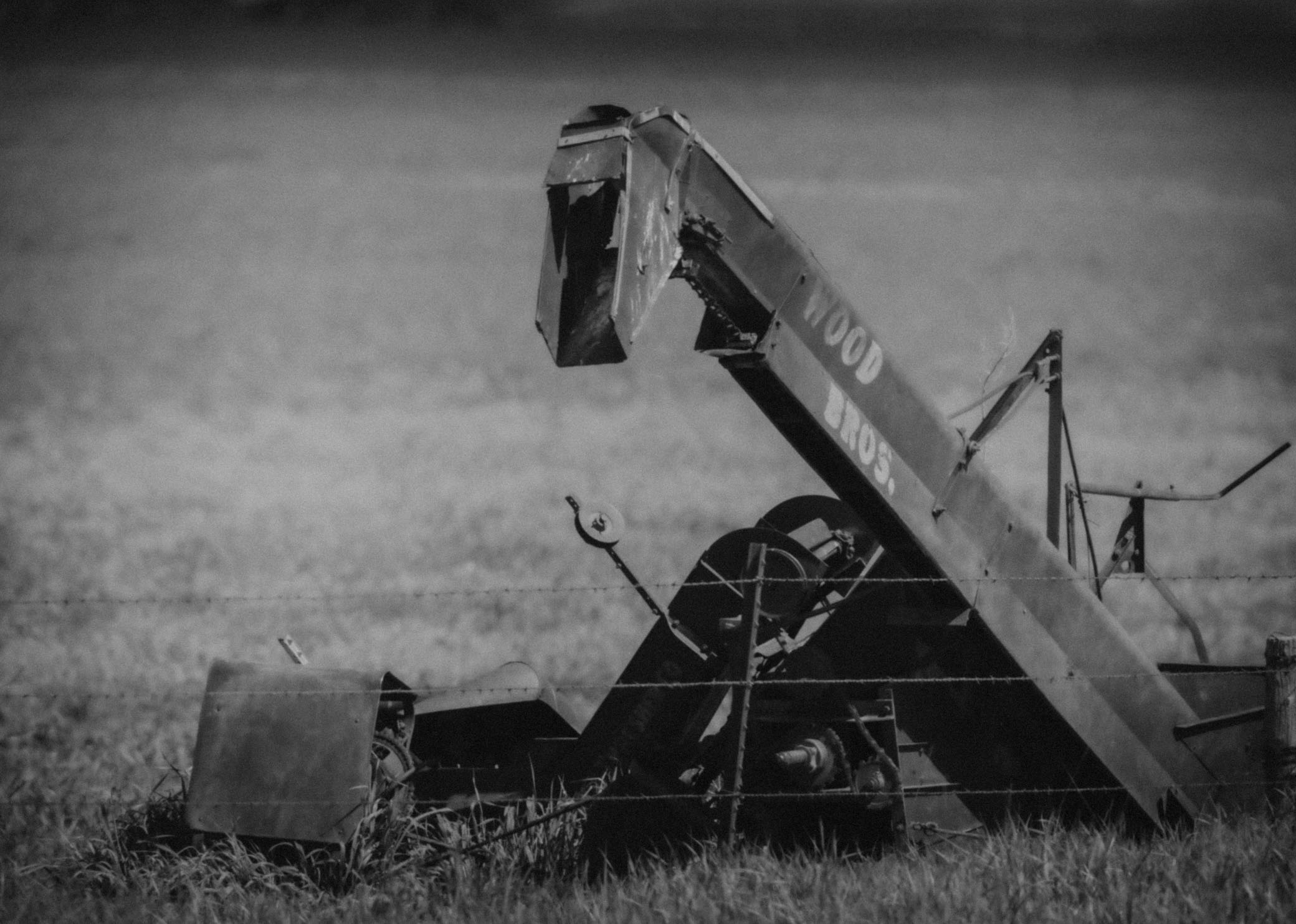
Dinosaur
Lacreek National Wildlife Refuge, Martin SD
May 25, 2022
Abandoned junk farm equipment over the fence from the Lacreek National Wildlife Refuge, Martin SD.
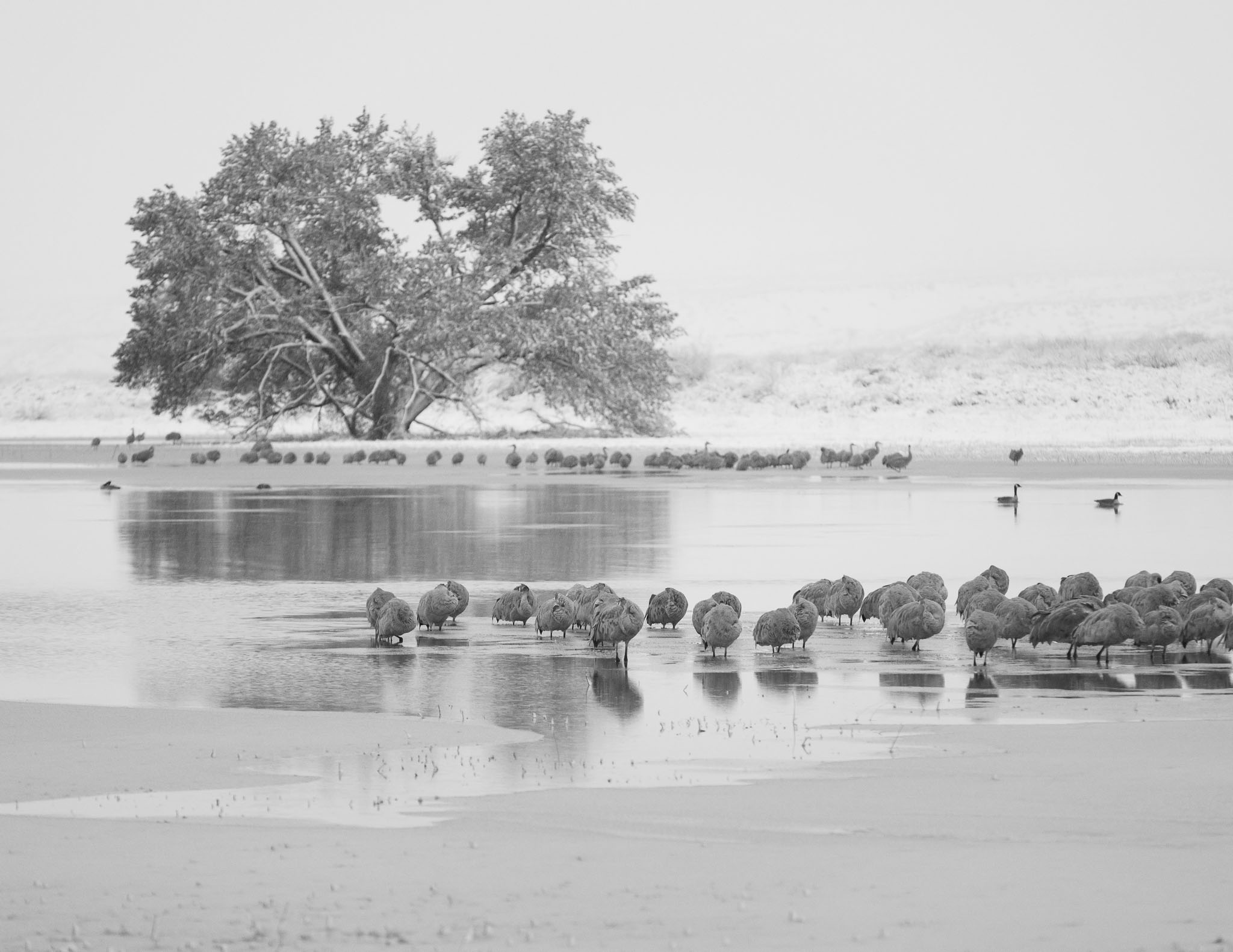
Snow at the Roost
Sandhill Cranes at the Roost, Bosque del Apache National Wildlife Refuge, San Antonio NM
November 28, 2019
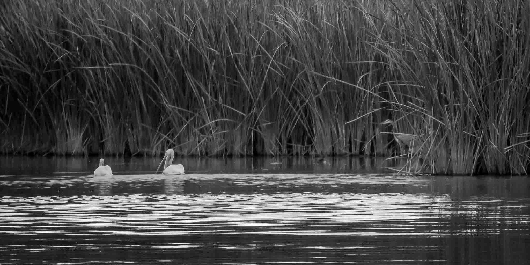
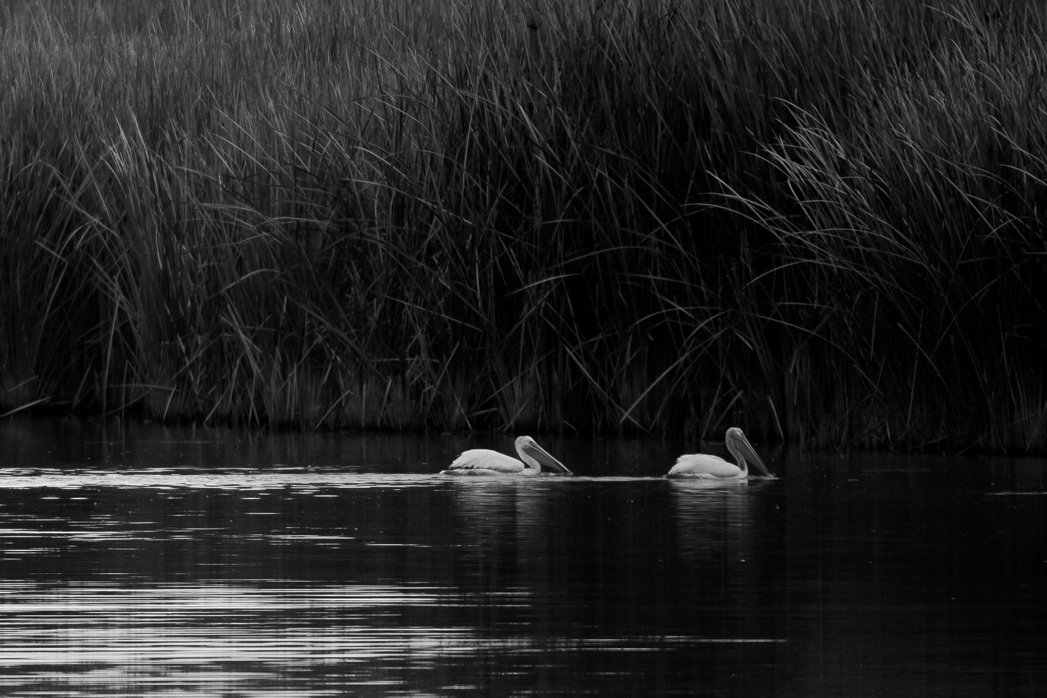
Daybreak
American White Pelicans, Bosque del Apache National Wildlife Refuge, San Antonio NM
November 1, 2016
There wasn't a lot going on at the Bosque Boardwalk to photograph - just a few pelicans going about their morning under this stunning red sky at sunrise.
It was a good outing - I got two nice images this beautiful morning.
Dawn's Early Light
Angel Peak Scenic Area, Bloomfield NM
October 17, 2016
Interesting light on Angel Peak this morning. I took this shot about 1/2 hour before sunrise. The upper peak was lit by the pre-dawn sun reflecting intensely red off a low band of clouds in the east which created a nice contrast with the darker canyons below and the dark foreground shaded by my RV parked to the east of my tripod.
Guardian Angels
Angel Peak from the Angel Peak Scenic Area Campground, Bloomfield NM
October 17, 2015
The shifting patchy light of a mostly cloudy day set the scene for this moody view of Angel Peak and it's neighboring pinacles in the badlands.
Angel Peak Scenic Area
The Angel Peak Scenic Area is a BLM recreation area located about 15 miles south of Bloomfield in San Juan County, New Mexico. The recreation area, more than 10,000 acres of rugged terrain, features Angel Peak (elevation 6,988 feet), colorful badlands and deep canyons.
Angel Peak and the higher terrain are made up of the Eocene San Jose Formation (sandstone), and the badlands are made up of the underlying Paleocene Nacimiento Formation: shale, mudstone, and fine sandstone.
Three picnic areas and a campground are located along the canyon rim overlooking Angel Peak and the Kutz Canyon badlands. Angel Peak Campground has nine sites available for tent camping, and features a short nature trail. Access to the area is via graded county road 7175, from US 550.
Wikipedia
Hangout
Bosque del Apache National Wildlife Refuge, San Antonio NM
November 15, 2015
I've often seen Bald Eagles hanging out in this photogenic tree in the past but none this fall yet. I'm pleased the Refuge cut the brush along this section of the Farm Loop making this photo possible.
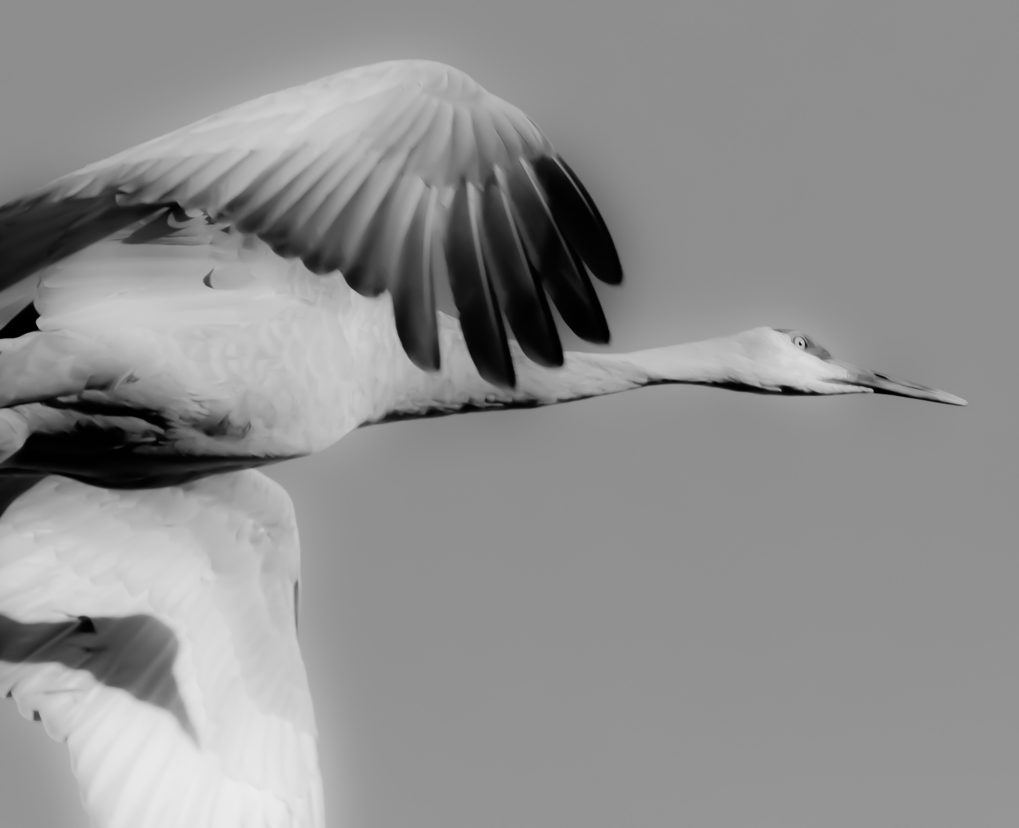
Sandhill Crane, A Portrait in Flight
Bosque del Apache National Wildlife Refuge, San Antonio NM
December 14, 2013
I don’t do a lot of black and white photos but this image lent itself nicely to a black and white treatment with the dramatic light from a sun low in the sky. I like it.
Mission Accomplished
Desiccated Yucca Seed Pod, Pancho Villa State Park, Columbus NM
March 12, 2016
The Yuccas at Pancho Villa State Park were in full bloom by the end of March last year. I see no new growth on them yet this year. Can they possibly bloom in the next two weeks? Spring growth in the Southwest can be dramatically fast but so much in the next two weeks seems a bit of a stretch. We shall see.
Eeeeew!
Rock Formations, City of Rocks State Park, Faywood NM
February 28, 2015
What do you see? I see a guinea pig getting in the face of a repulsed older guy.
The rock formations here at City of Rocks are endlessly fascinating to me and I love wandering among the rocks seeking out and photographing the interesting stuff I find. They are so cool and constantly changing as the sun moves through the sky.
I wonder what those native to the area thought about these formations. It's obvious they lived here or at least camped here for a while. There are several metates worn into the rocks where they ground their grains. I wonder if some of the formations were of special significance to them. Does anyone know?
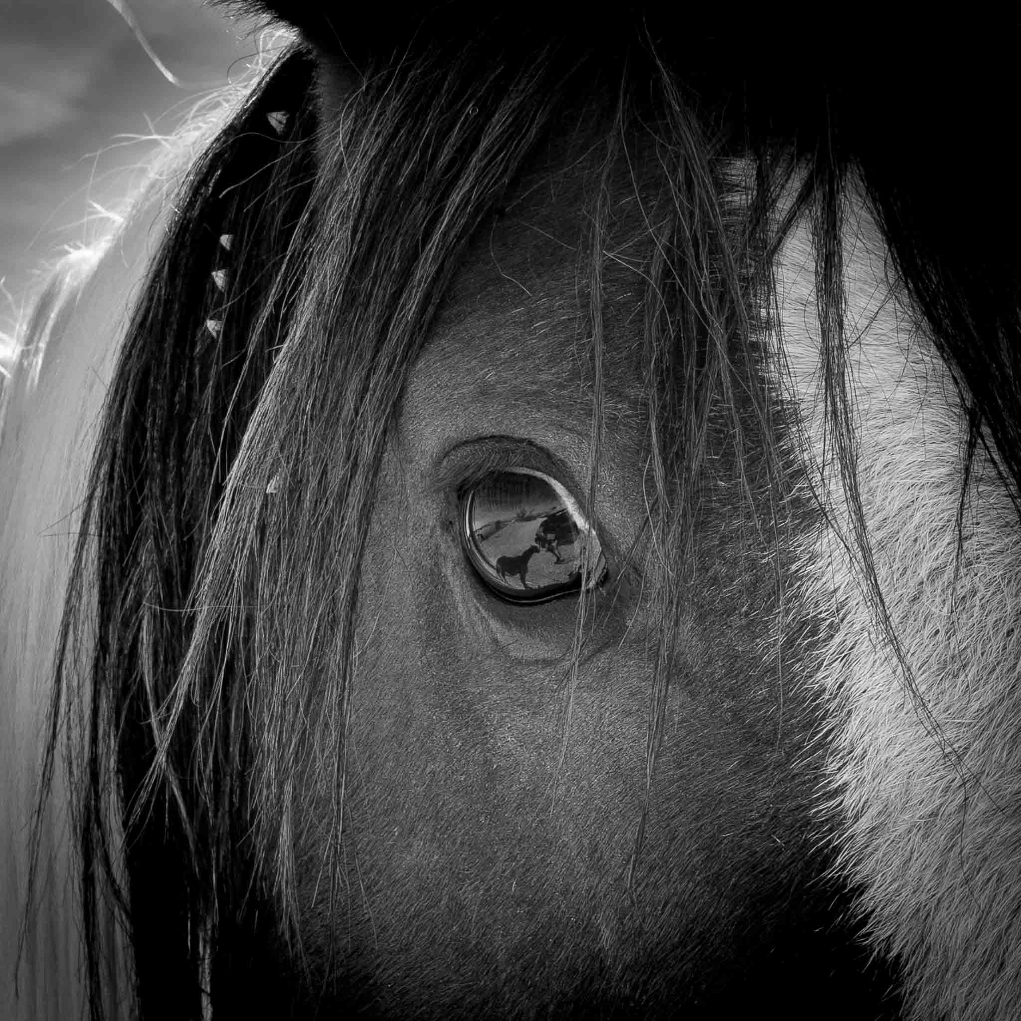
Horsefeathers
Wild Horse at Cold Creek NV
October 22, 2014
On reflection.
Shadowed
Sandhill Crane, Bosque del Apache National Wildlife Refuge, San Antonio NM
November 28, 2014
Nice added touch.
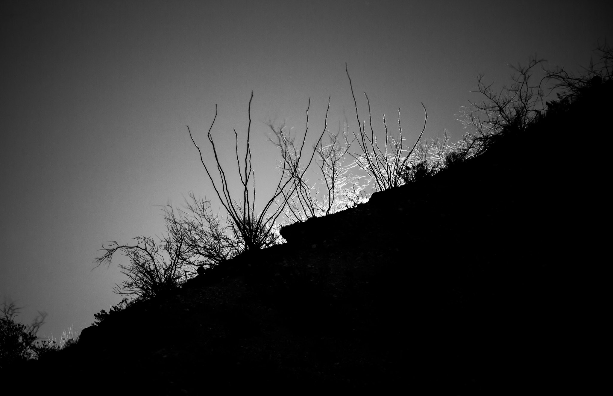
Ocotillo Moonrise
Full Moon Rising, Caballo Lake State Park, Caballo NM
December 24, 2015
Santa and his crew surely had an easy time navigating the heavens this brightly moonlit Christmas eve.
Merry Christmas everyone.