San Rafael Swell Area, South-central Utah
San Rafael Swell
The San Rafael Swell is a large geologic feature located in south-central Utah, United States about 16 miles (26 km) west of Green River. The San Rafael Swell, measuring approximately 75 by 40 miles (121 by 64 km), consists of a giant dome-shaped anticline of sandstone, shale, and limestone that was pushed up during the Paleocene Laramide Orogeny 60–40 million years ago. Since that time, infrequent but powerful flash floods have eroded the sedimentary rocks into numerous valleys, canyons, gorges, mesas, buttes, and badlands.
The swell is part of the Colorado Plateau physiographic region.
Interstate 70 divides the Swell into northern and southern sections, and provides the only interstate access to the region. The swell lies entirely within Emery County. The northern Swell is drained mainly by the San Rafael River, while the southern Swell is drained mainly by Muddy Creek, which eventually joins the Fremont River to become Dirty Devil River northeast of Hanksville, Utah. The Dirty Devil River flows southward into the Colorado River, while the San Rafael River joins the Green River before it also flows into the Colorado. Muddy Creek cuts into the western edge of the Swell, exits at Muddy Creek Gorge, and then flows across the Blue Hills Badlands near Caineville to its confluence with the Fremont River.
Wikipedia: San Rafael Swell
Grassy Trail Creek {more...}
Westbound Along Grassy Trail Creek {more...}
Detail, Buried Forest Concretions {more...}
Coming 'Round the Bend {more...}
Factory Butte {more...}
Addenda to Photos
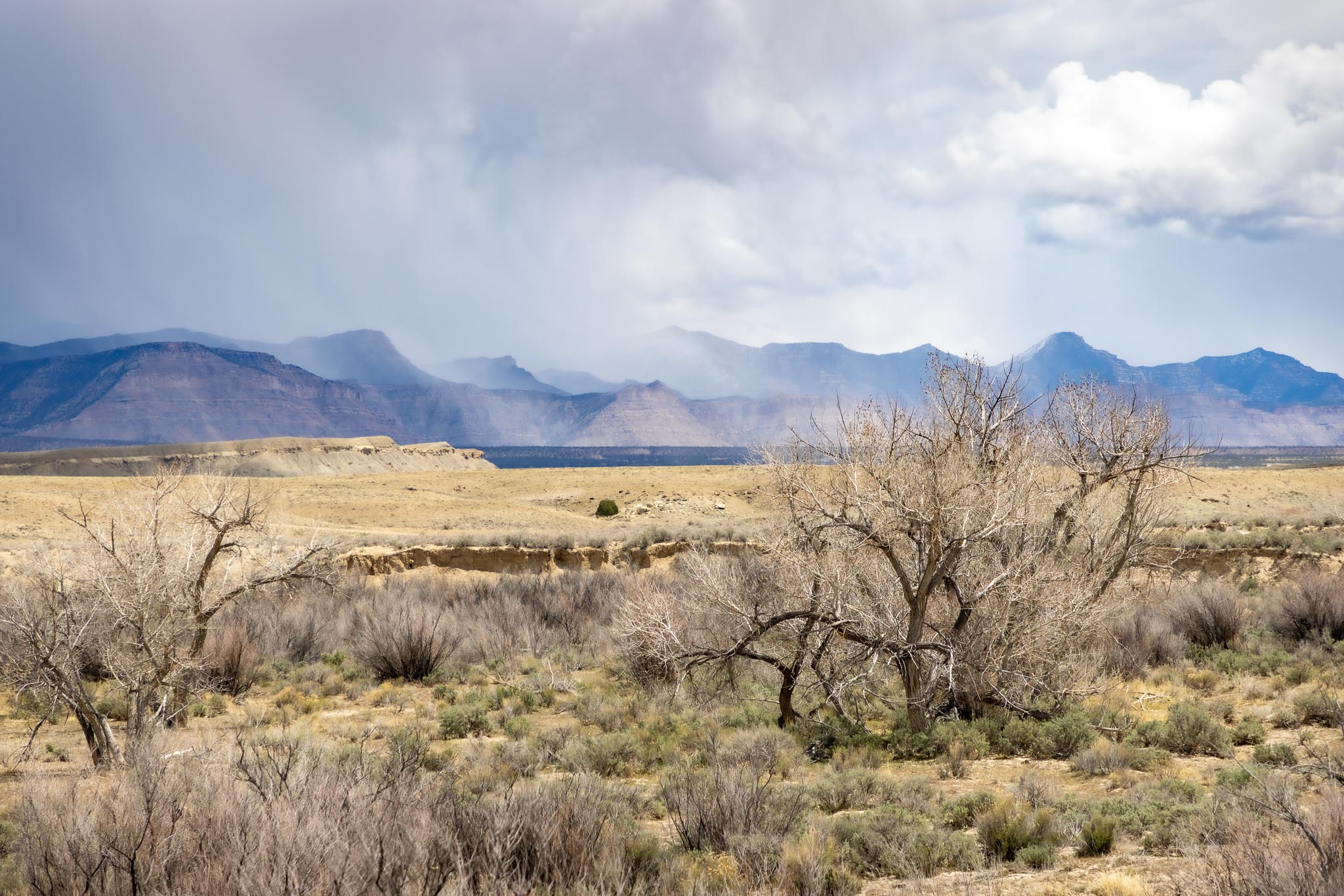
Grassy Trail Creek
Price River Road, Wellington UT
April 25, 2022
Grassy Trail Creek is a largely ephemeral tributary of the Price River near Wellington UT.
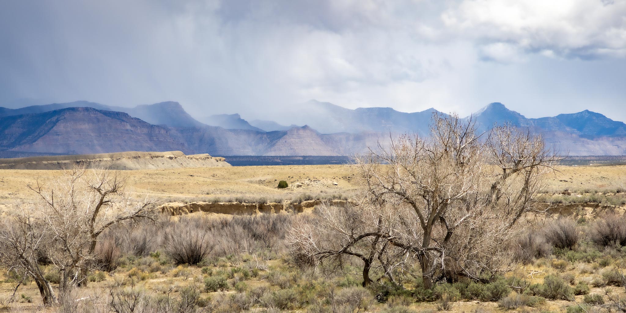
Westbound Along Grassy Trail Creek
Price River Road, Wellington UT
April 24, 2022
Grassy Trail Creek is a largely ephemeral tributary of the Price River near Wellington UT. Here the Chicago to San Francisco mainline passes along the creek.
The Price River
The Price River is a 137-mile-long (220 km) southeastward flowing river in Carbon, Utah and Emery counties in eastern Utah. It is tributary to the Green River, itself a tributary to the Colorado River.
The river's early name was the White River, but it was changed in the summer of 1869 when LDS Bishop William Price of Goshen, Utah, explored the region and renamed it, making the White River above Colton into a tributary of the Price River. The town of Price was later named after the river.
Wikipedia: Price River UtahWellington UT
Wellington is a city in Carbon County, Utah, United States. The population was 1,676 at the 2010 census. The community was settled in 1878 by a band of thirteen Mormons led by Jefferson Tidwell. The town was named for Justus Wellington Seeley, Jr., of the Emery County Court. Many residents commute to nearby Price for their jobs, or work in one of the various coal mines in the area.
Wellington is located southwest of the center of Carbon County at 39°32′22″N 110°43′47″W (39.539476, -110.729667), along U.S. routes 6/191, which leads northwest 6 miles (10 km) to Price, the county seat, and southeast 57 miles (92 km) to Green River.
According to the United States Census Bureau, the city has a total area of 5.1 square miles (13.3 km2), all land. It is just north of the Price River, a southeast-flowing tributary of the Green River.
Wikipedia: Wellington Utah
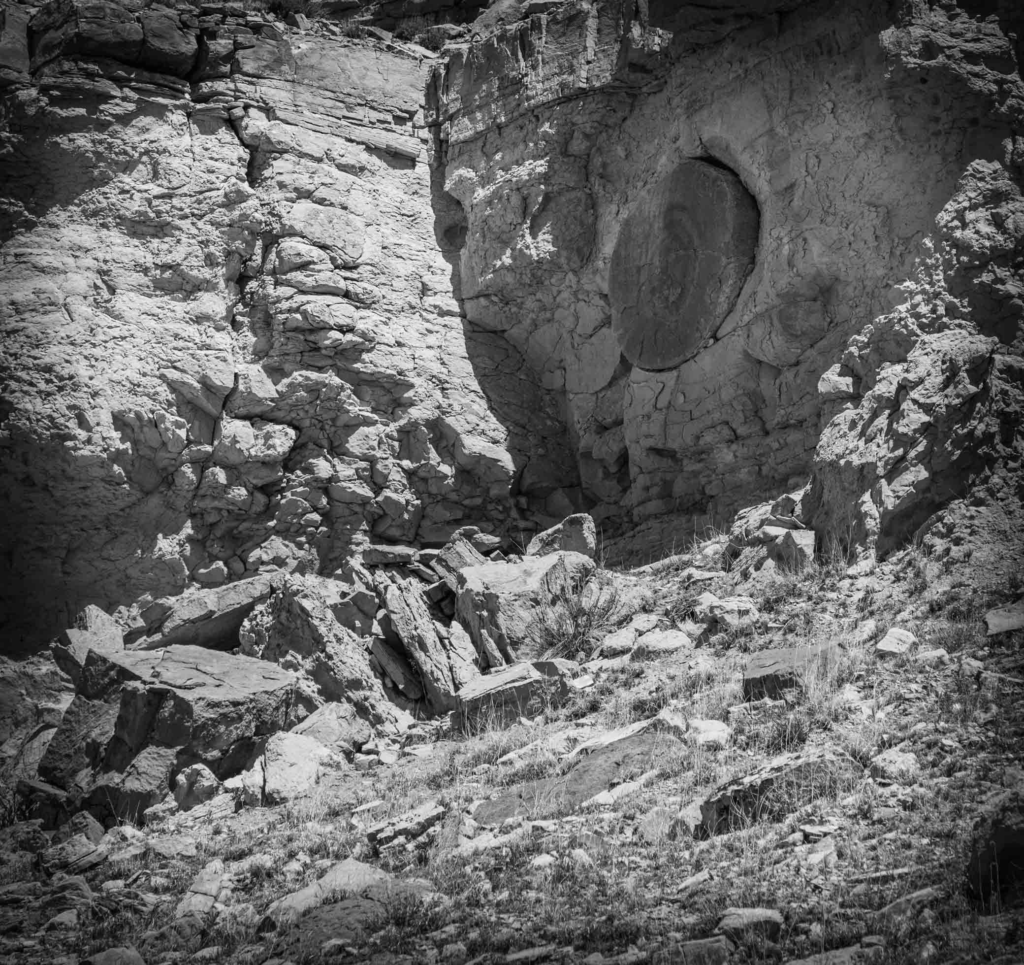
Detail, Buried Forest Concretions
Near Grassy Trail Creek, Wellington UT
April 25, 2022
A detail of one of the many interesting concretions embedded along this cliff face. It's about a mile hike in from the parking lot to the cliff face on a fairly easy trail, and is well worth the effort to see this odd bit of geology.

Buried Forest Concretions
Cannonball Concretions in a Treeless “Buried Forest,” Carbon County, Utah
Near the start of the 20th century, a Utah photographer captured an image he labeled “Buried Forest,” perhaps thinking multiple large circular objects exposed in the cliff face were petrified logs (spoiler alert, they were not). Recently, rediscovery of the “Buried Forest” concretions came at the right time to give folks in Carbon County a distraction from COVID-19 confinement. Price, Utah, resident Scott Wheeler’s curiosity to find the location of an old black-and-white photo and his desire to share the historic and geologic find with others led to its eventual designation by the U.S. Bureau of Land Management (BLM) as an interpretive site.
The photo, taken circa 1899, shows large spheres of rock up to 8 feet in diameter embedded in a cliff that photographer George Edward Anderson had deemed the “Buried Forest.” Anderson identified the location as Sunnyside, which we know today as a town at the base of the Book Cliffs. After months of work, Scott, with the help of Google Earth and friend Alan Peterson, found the cliff 10 miles to the southwest in the Mounds area above Grassy Trail Creek, a tributary to the Price River. Discovering that Mounds had been called Sunnyside in the 1800s, they were able to hone in on the correct location.
Cannonball Concretions in a Treeless “Buried Forest,” Carbon County, Utah by Pete KilbourneConcretion
A concretion is a hard, compact mass of matter formed by the precipitation of mineral cement within the spaces between particles, and is found in sedimentary rock or soil. Concretions are often ovoid or spherical in shape, although irregular shapes also occur. The word 'concretion' is derived from the Latin concretio "(act of) compacting, condensing, congealing, uniting", itself from con meaning 'together' and crescere meaning "to grow". Concretions form within layers of sedimentary strata that have already been deposited. They usually form early in the burial history of the sediment, before the rest of the sediment is hardened into rock. This concretionary cement often makes the concretion harder and more resistant to weathering than the host stratum.
There is an important distinction to draw between concretions and nodules. Concretions are formed from mineral precipitation around some kind of nucleus while a nodule is a replacement body.
Descriptions dating from the 18th century attest to the fact that concretions have long been regarded as geological curiosities. Because of the variety of unusual shapes, sizes and compositions, concretions have been interpreted to be dinosaur eggs, animal and plant fossils (called pseudofossils), extraterrestrial debris or human artifacts.
Wikipedia: Concretion
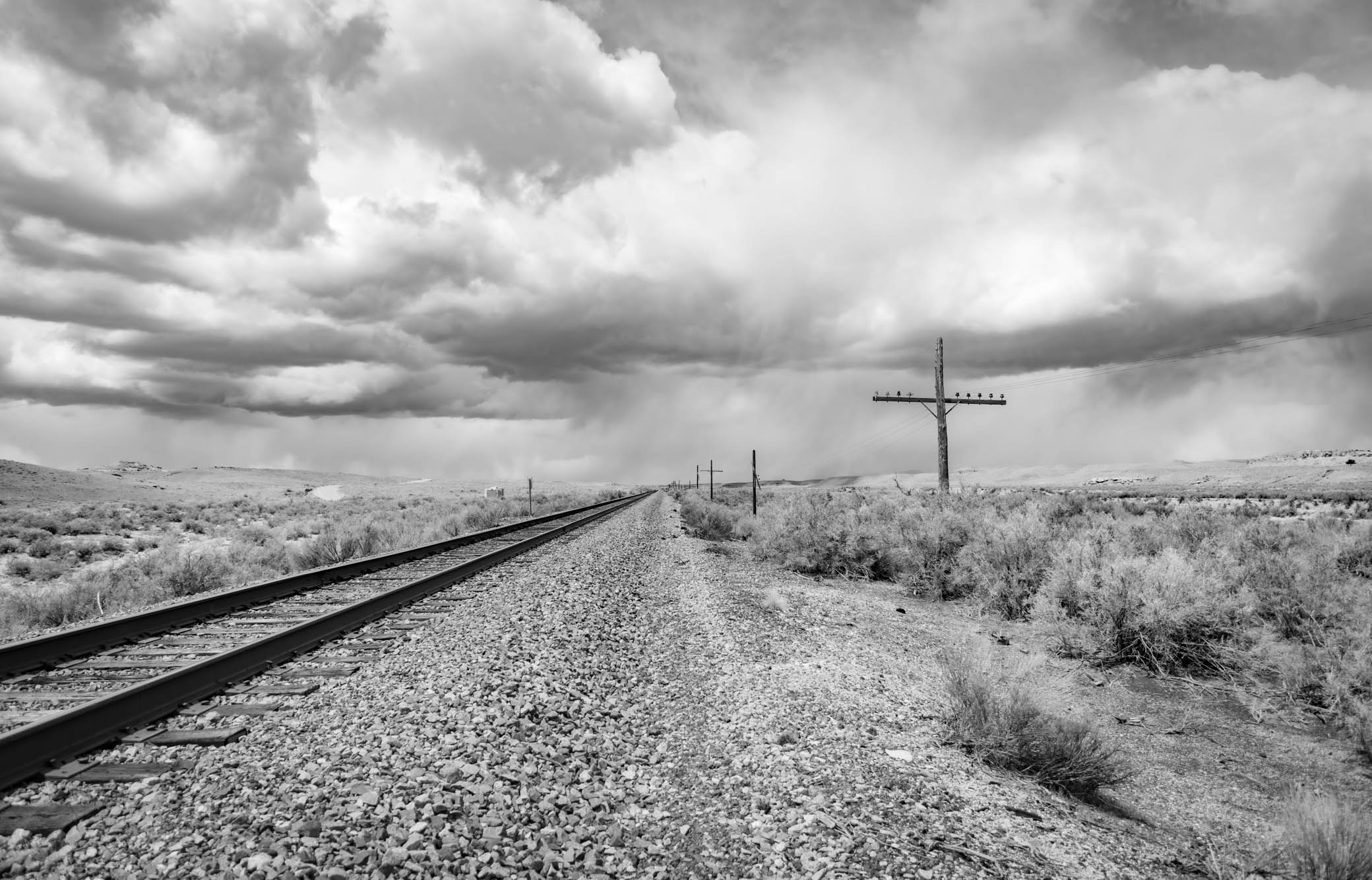
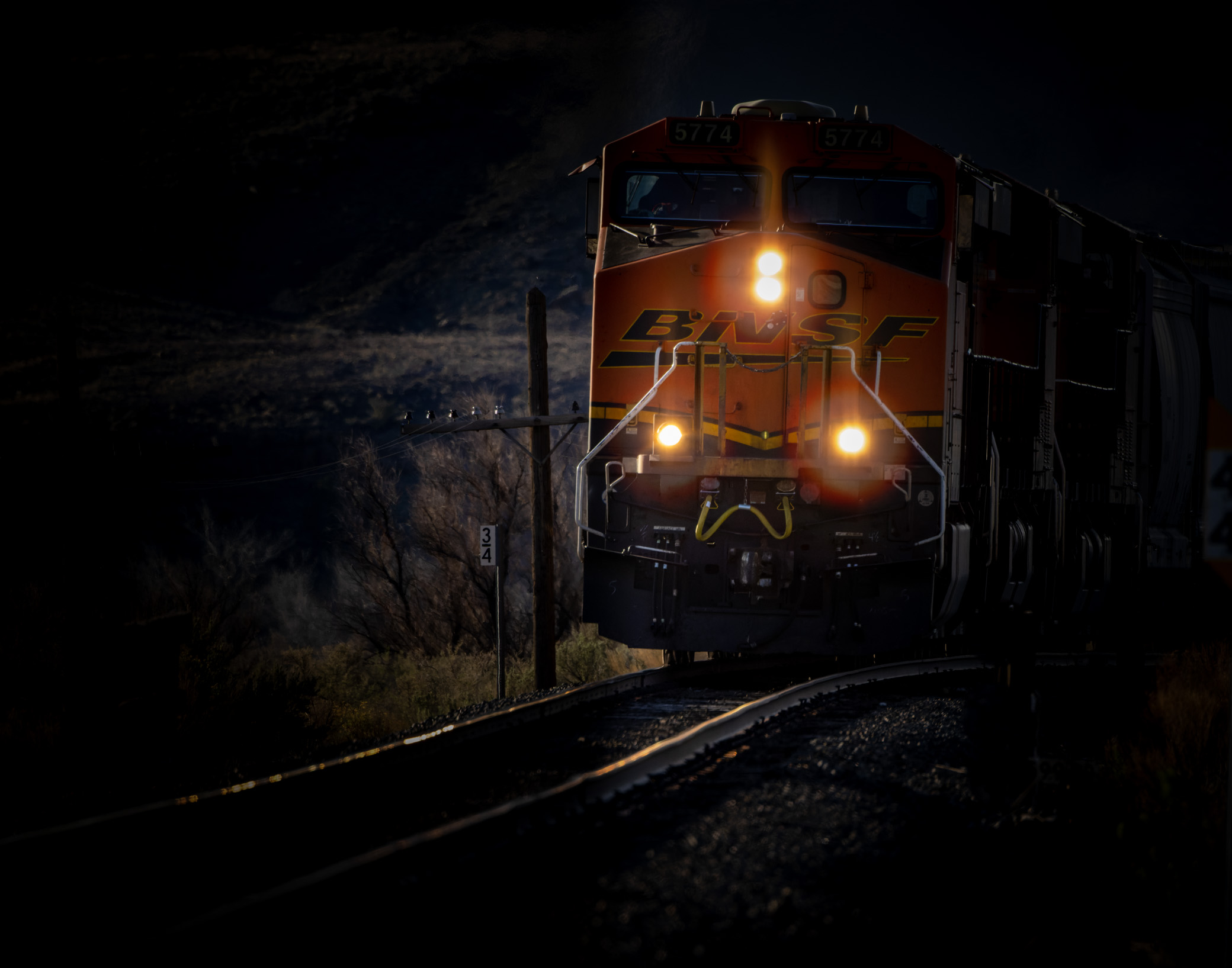
Coming 'Round the Bend
Price River Road, Wellington UT
April 25, 2022
BNSF Railway
BNSF Railway (reporting mark BNSF) is one of the largest freight railroads in North America. One of seven North American Class I railroads, BNSF has 35,000 employees, 32,500 miles (52,300 km) of track in 28 states, and nearly 8,000 locomotives. It has three transcontinental routes that provide rail connections between the western and eastern United States. BNSF trains traveled over 169 million miles (272 million kilometers) in 2010, more than any other North American railroad.
The BNSF Railway Company is the principal operating subsidiary of parent company Burlington Northern Santa Fe, LLC. Headquartered in Fort Worth, Texas, the railroad's parent company is a wholly owned subsidiary of Berkshire Hathaway, Inc., of Omaha, Nebraska. The current CEO is Kathryn Farmer.
According to corporate press releases, the BNSF Railway is among the top transporters of intermodal freight in North America. It also hauls bulk cargo, including enough coal to generate around 25% of the electricity produced in the United States.
The creation of BNSF started with the formation of a holding company on September 22, 1995. This new holding company purchased the Atchison, Topeka and Santa Fe Railway (often called the "Santa Fe") and Burlington Northern Railroad, and formally merged the railways into the Burlington Northern and Santa Fe Railway on December 31, 1996. On January 24, 2005, the railroad's name was officially changed to BNSF Railway Company using the initials of its original name.
On November 3, 2009, Warren Buffett's Berkshire Hathaway announced it would acquire the remaining 77.4 percent of BNSF it did not already own for $100 per share in cash and stock—a deal valued at $44 billion. The company is investing an estimated $34 billion in BNSF and acquiring $10 billion in debt. On February 12, 2010, shareholders of Burlington Northern Santa Fe Corporation voted in favor of the acquisition.
BNSF and its chief competitor, the Union Pacific Railroad, have a duopoly on all transcontinental freight rail lines in the Western, Midwestern and Southern United States and share trackage rights over thousands of miles of track.
Wikipedia: BNSF Railway
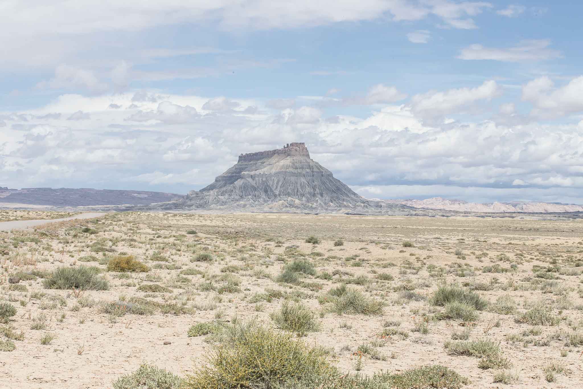
Factory Butte
Caineville Badlands, Caineville UT
May 6, 2015
Though Factory Butte is a bit south of the San Rafael Swell I include this image here.
The badlands, including Factory Butte, in the Caineville Badlands east of Capitol Reef are generally a rather depressing dull gray but the washed out effect of the mid-day cloudy-bright sky on Factory Butte was striking this day.