Landscapes
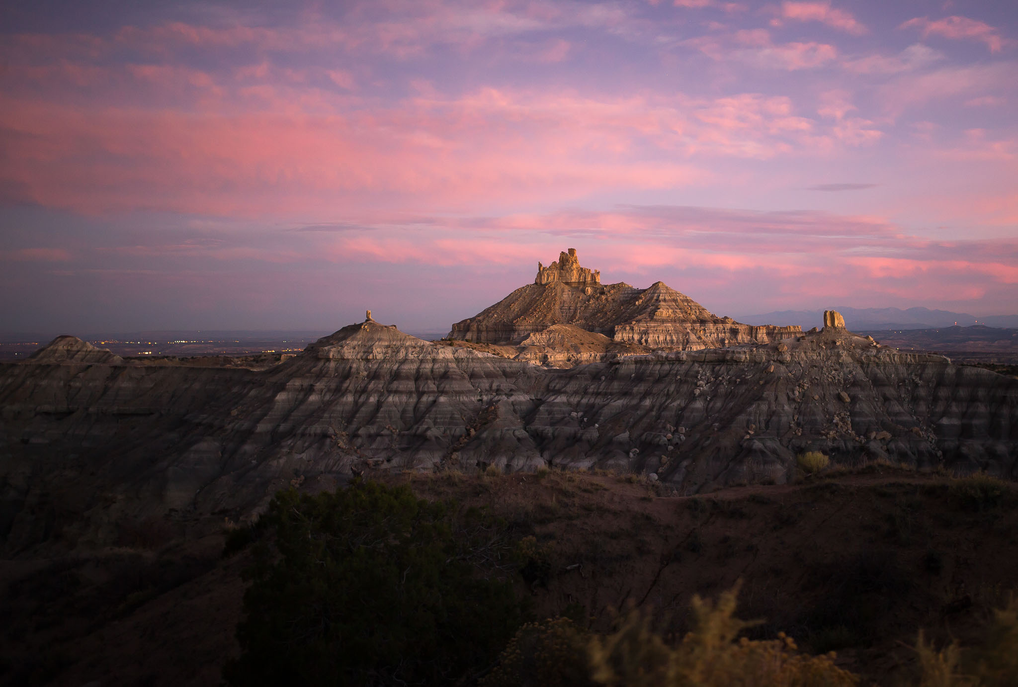
Daybreak {more...}
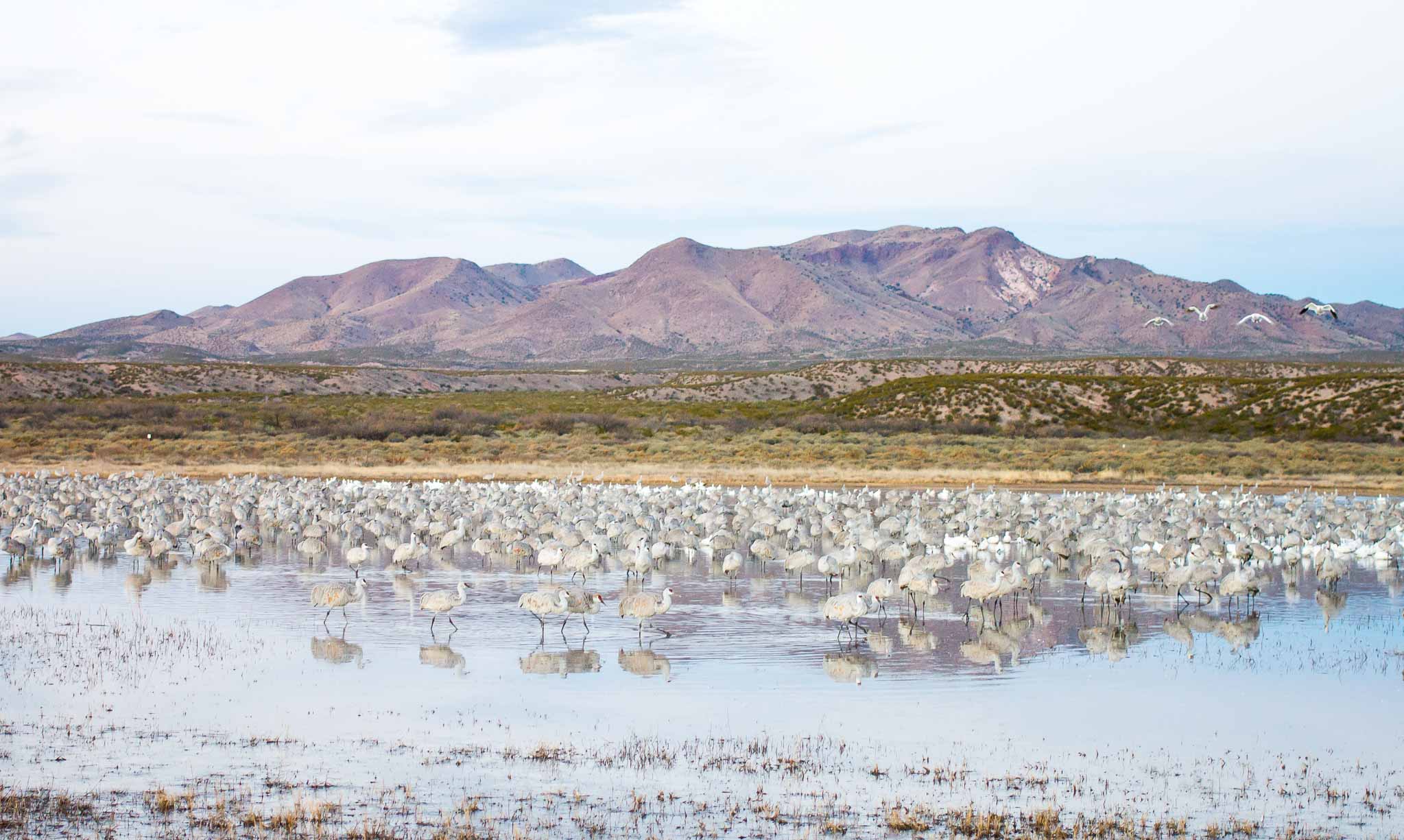
Morning at the Roost {more...}
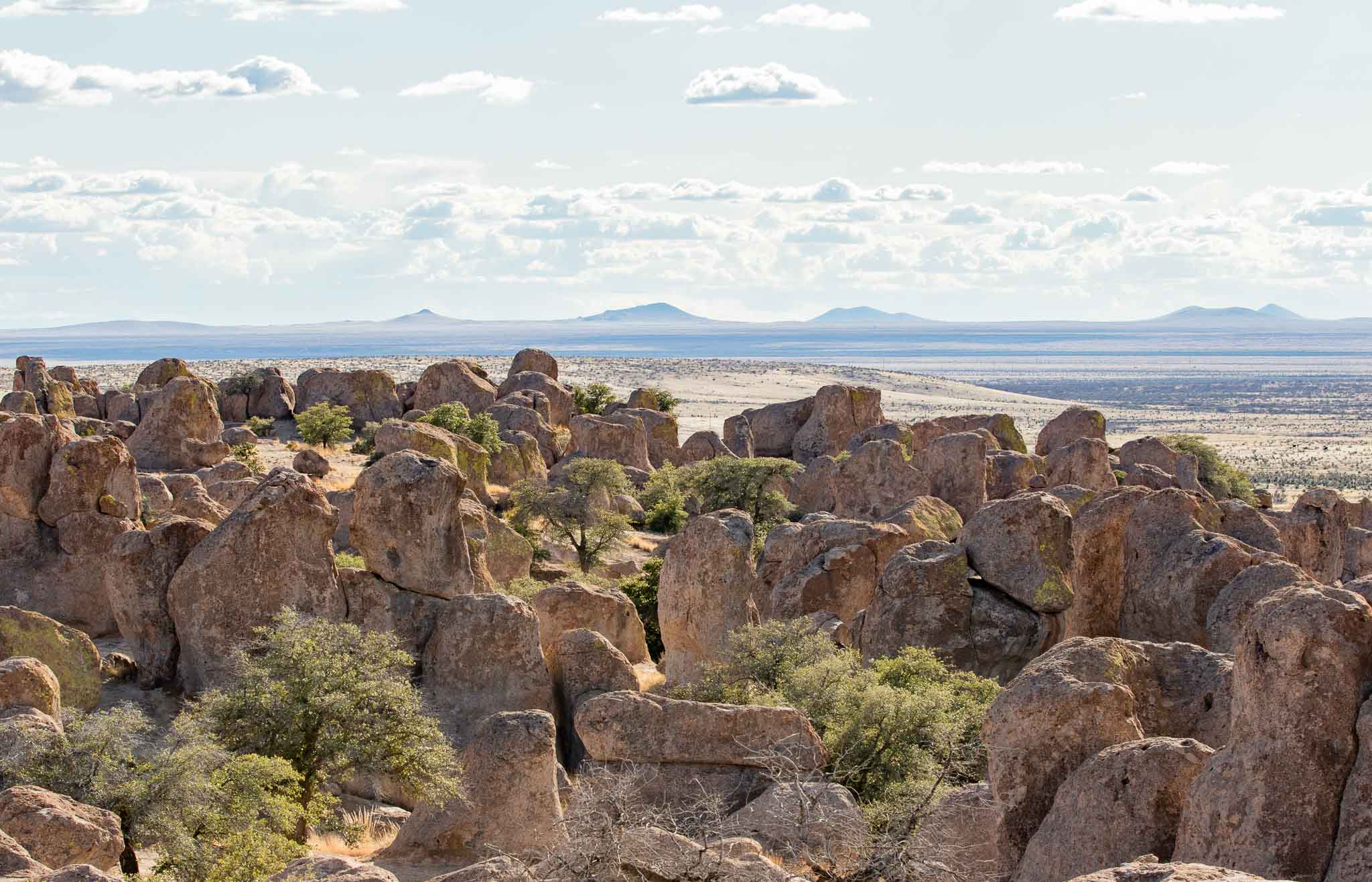
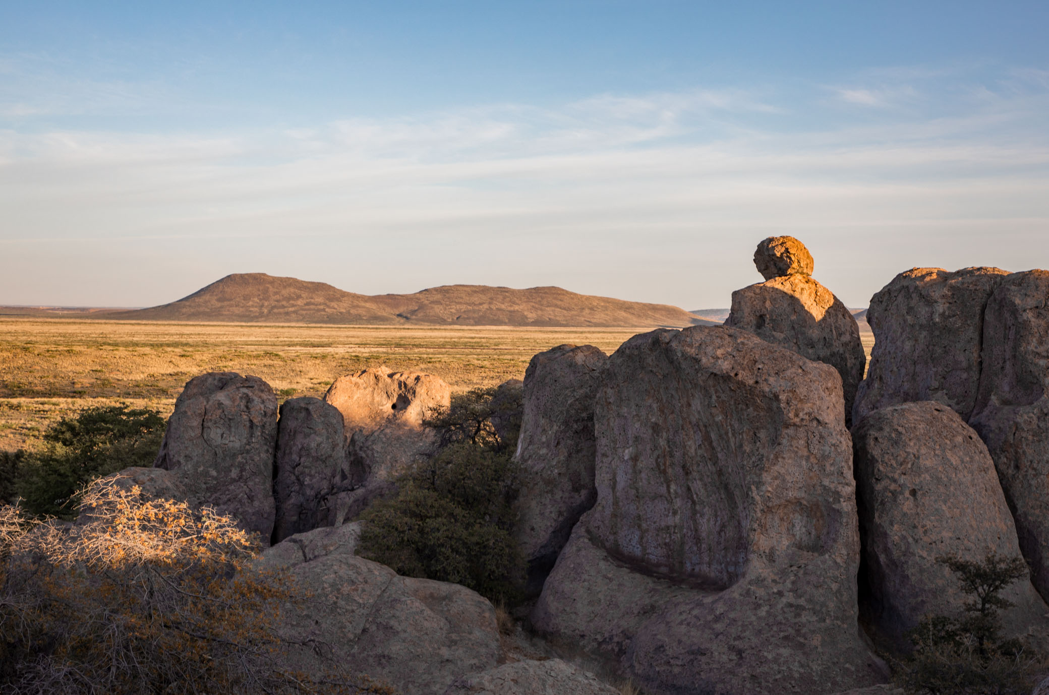
Rocks {more...}
Sunrise {more...}
The Reader {more...}
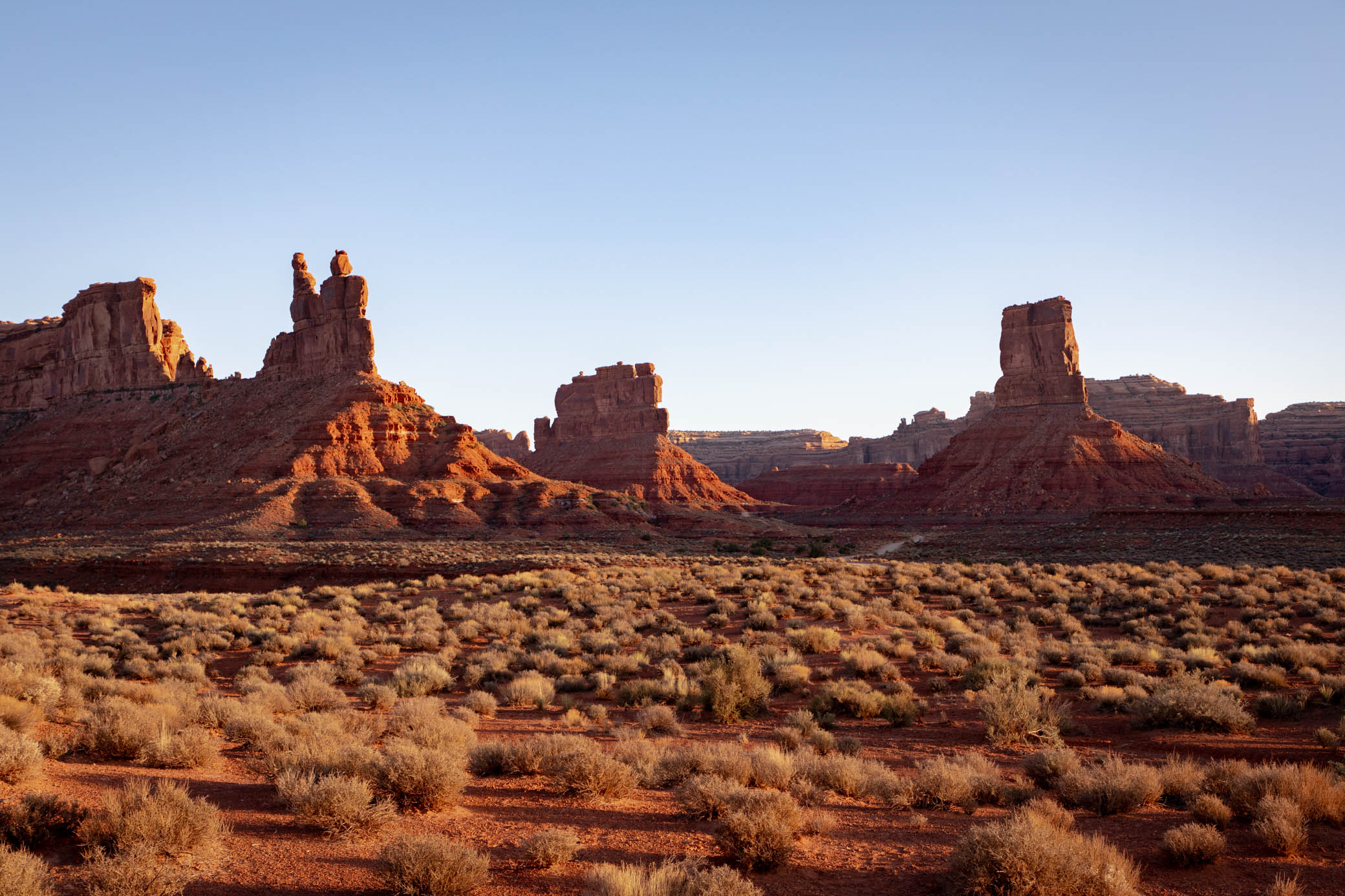
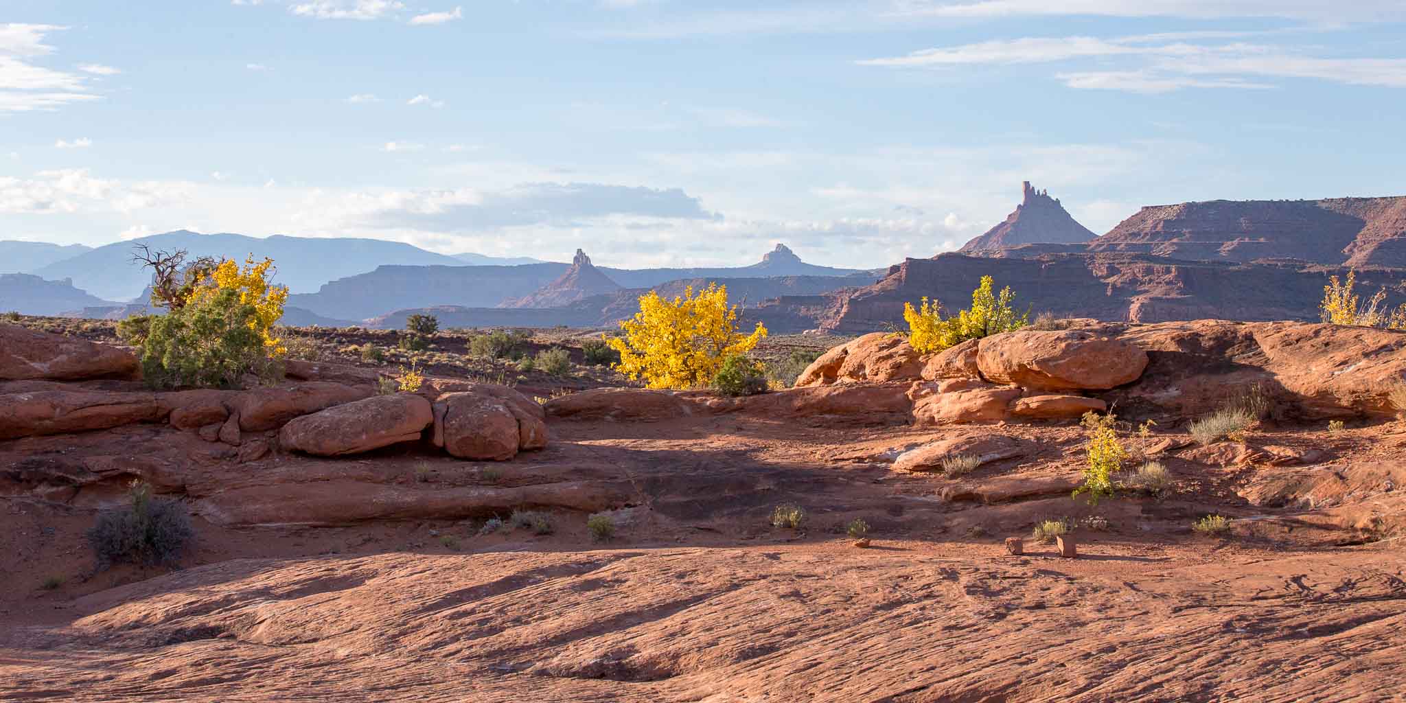
Valley of the Gods {more...}
Grassy Trail Creek {more...}

Sunrise After the Storm {more...}
Lone Pine {more...}
Canyon Color {more...}
Orchard Ranch {more...}
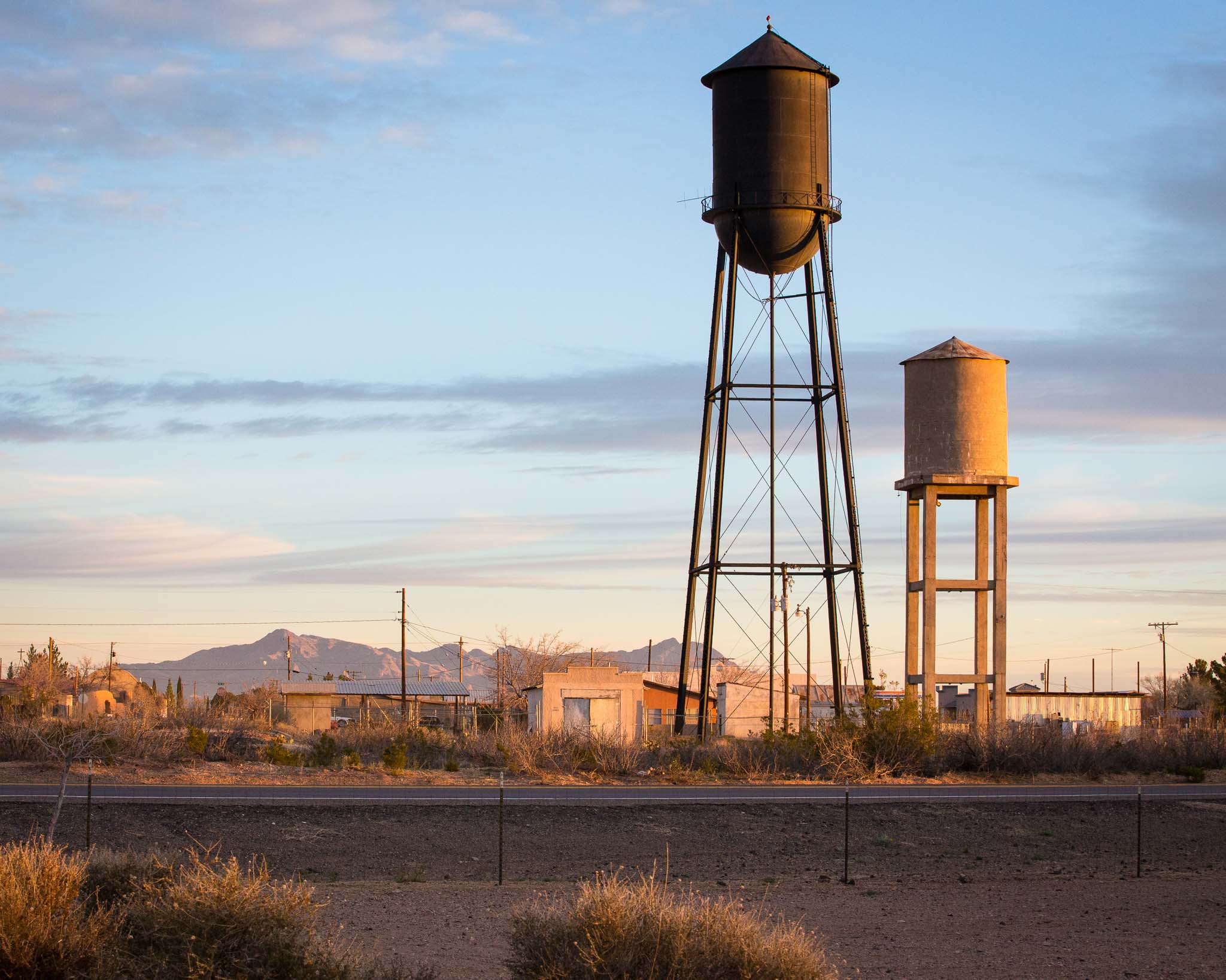
Abandoned {more...}

Dante's View {more...}
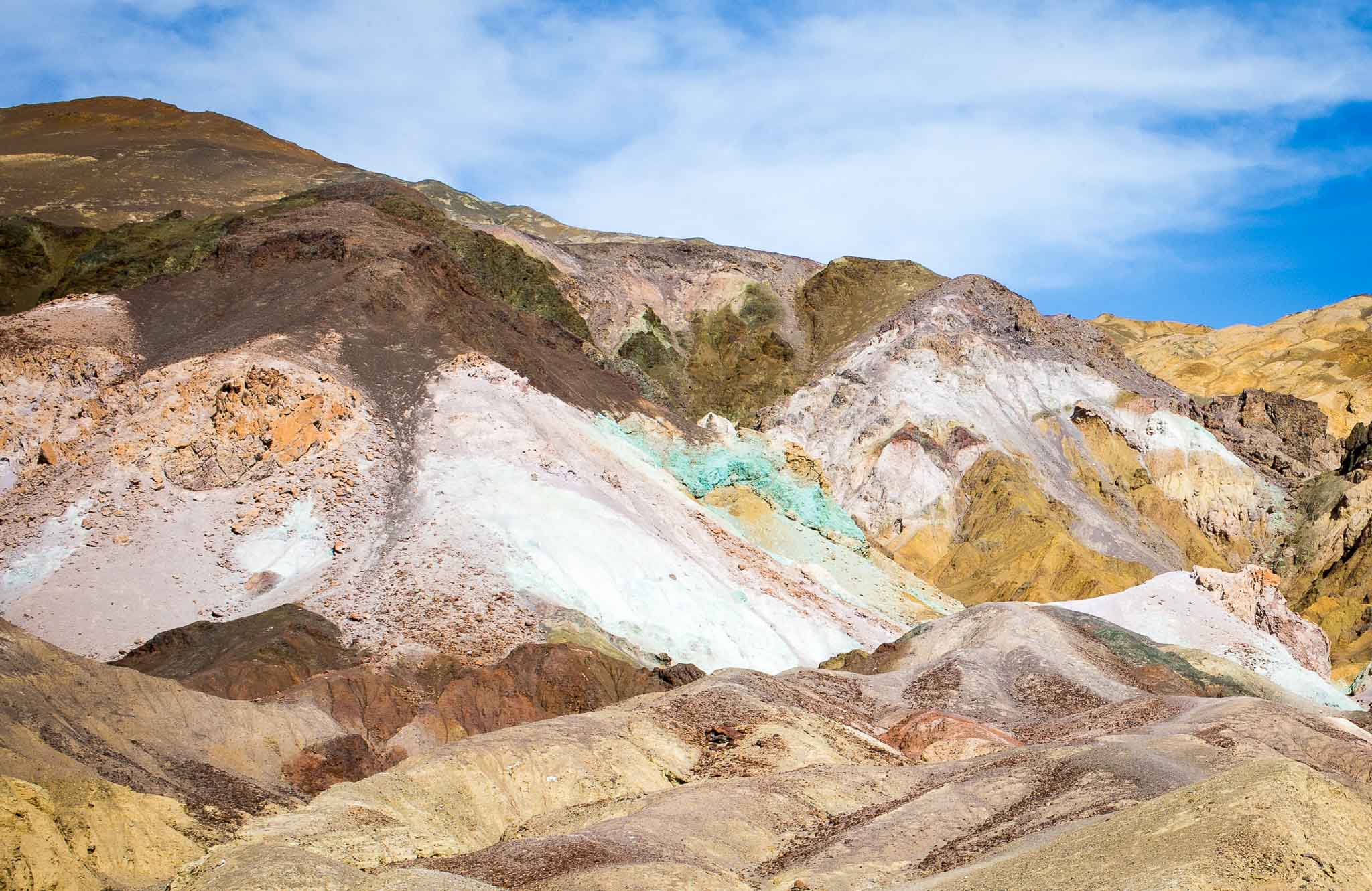
Artist's Palette {more...}
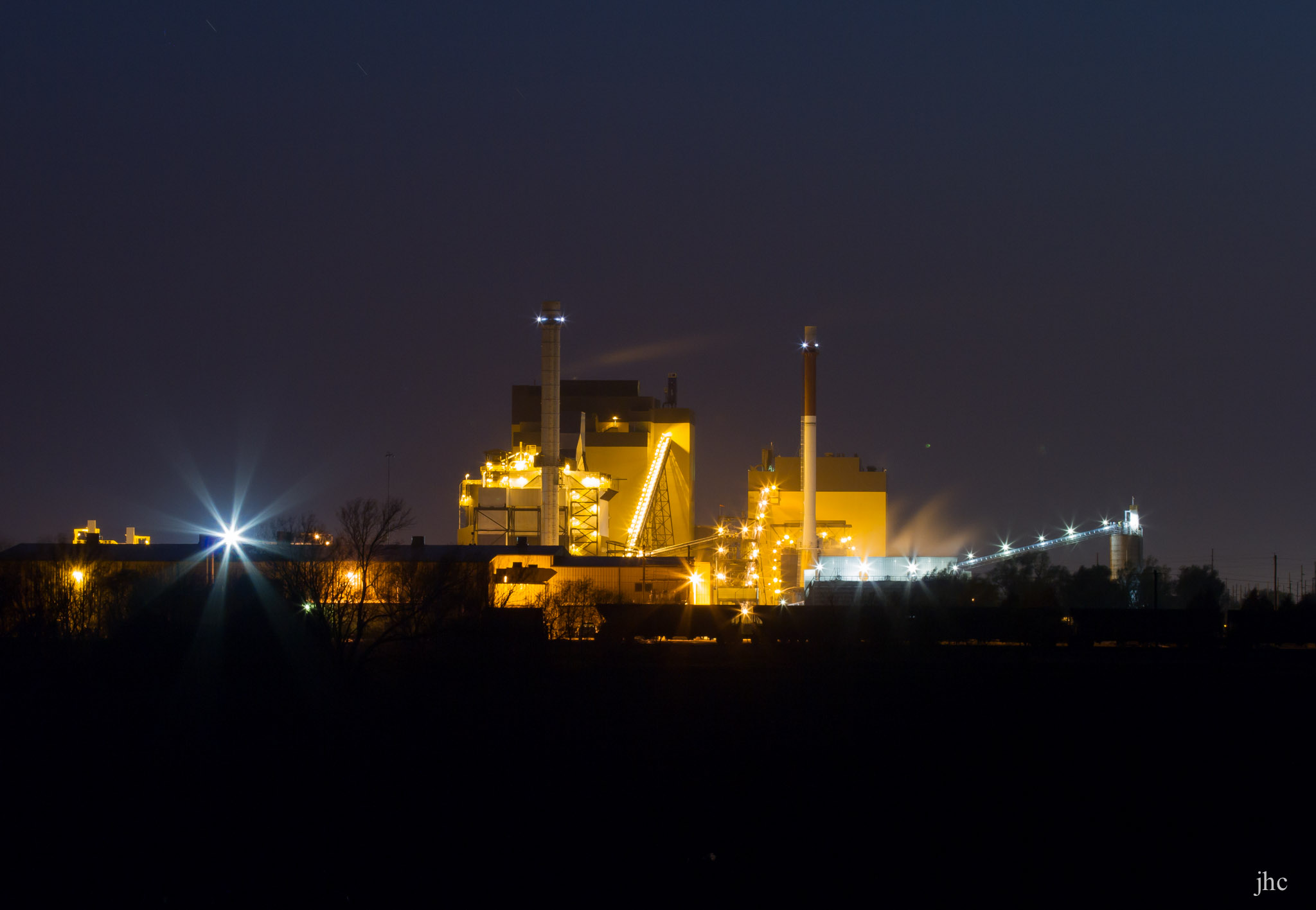
Hastings Powers the Night {more...}
Addenda to Photos
Daybreak
Angel Peak Scenic Area, Bloomfield NM
October 16, 2016
I was a little disappointed to see clouds this morning. I was hoping to catch the Super Moon setting beyond the badlands. No such luck but this sky blue pink over Angel Peak at first light was a nice consolation.
Head over to Angel Peak Scenic Area for more images of this fascinating area.
Morning at the Roost
Sandhill Cranes and Snow Geese at the Pond, Bosque del Apache National Wildlife Refuge, San Antonio NM
December 22, 2014
On a good day this is the scene that greets us photographers lined up along the edge of the pond, waiting for the action to begin at sunrise.
Head over to Bosque del Apache National Wildlife Refuge for more images of the refuge.
Rocks
City of Rocks State Park, Faywood NM
March 4, 2015
City of Rocks is an island of rocks within the larger context of the surrounding open country. These amazing rock formations are the remains of solidified and eroded volcanic ash from an eruption 35 million years ago.
Pareidolia (parr-i-DOH-lee-ə), the phenomenom of seeing images of animals and faces in natural and ordinary objects, is such fun! I keep seeing animal and human forms in these rock formations. Do you? See some I've photographed in my Pareidolia Collection.
It's early March and one wouldn't normally expect to see green leaves on the trees. It turns out most of them are Emory Oaks, small oak trees native to this area that retain their leaves through the winter until new leaves are produced in the spring.
Head over to City of Rocks State Park for more images of this fascinating pile.
Sunrise
Columbus NM
February 20, 2015
I took this picture from the Visitor Center at Pancho Villa State Park. I like this park and the short walk into town for a green chili cheeseburger at the Patio Cafe. Of late I’ve been alternating between here and City of Rocks State Park about 60 miles to the north from late winter until the weather warms enough to head to the Four Corners area for my annual canyon country fix.
Head over to Pancho Villa State Park for more images of this park.
The Reader
Mimetolith at Sunrise, City of Rocks State Park, Faywood NM
April 11, 2017
I caught this guy reading just as the rising sun came broke over the rocks.
Mimetoliths are a form of pareidolia found in rocks that come to mimic recognizable forms through the random processes of formation, weathering and erosion. Usually the rock is larger than the object it resembles, such as a cliff profile resembling a human face.
Head over to City of Rocks State Park for more images of this fascinating pile.
Valley of the Gods
Mexican Hat UT
May 17, 2018
Head over to Valley of the Gods for more images of this wonderful area.
Valley of the Gods
You might ask yourself, “What is Valley of the Gods”? Valley of the Gods is a scenic, sandstone valley with absolutely stunning geologic formations. It is located approximately 15 miles southwest of Bluff and about 35 miles from Monument Valley (see directions below). Valley of the Gods is now part of Bears Ears National Monument.
Visitors will find many scenic locations to stop and explore this special landscape. With nearby Monument Valley taking first prize for fame, visitors will encounter fewer tourists while meandering through Valley of the Gods and can enjoy a more personal experience. Permits are not required and there are no fees to drive Valley of the Gods unlike Monument Valley.
Locals have given the rock formations in Valley of the Gods names such as Rooster Butte, Setting Hen Butte, and Balanced Rock/Lady in a Tub. As you drive through Valley of the Gods, think about names you would give to these formations.
Geology
This geological masterpiece, though a quarter of the size of its celebrated neighbor, Monument Valley, boasts a royalty of rich colors and fantastic formations, and is quite stunning. The formations are sculpted from Cedar Mesa sandstone dating to the Permian period, around 250 million years ago.
Valley of the Gods sits at the base of Cedar Mesa. Rocks were deposited by the shallow sea that covered this area about 250 million years ago. After the water receded, the iron in the rocks mixed with oxygen to form rust. This resulted in the rich red and purple colors. Eroded by water, wind, and ice over millions of years, the rock was carved into the unique buttes, monoliths (single massive stone or rock), pinnacles and other geological features as seen today.
The Valley of the Gods is truly a geological masterpiece, rightfully earning its reputation as “a photographer’s paradise.”
The valley is public land managed by the Bureau of Land Management. There are no entrance fees and no services of any kind in the valley. Dispersed camping is permitted at previously disturbed sites, though campfires are not allowed.
Bluff Utah
Grassy Trail Creek
Price River Road, Wellington UT
April 25, 2022
Grassy Trail Creek is a largely ephemeral tributary of the Price River near Wellington UT.
Head over to San Rafael Swell for more images of this interesting area.
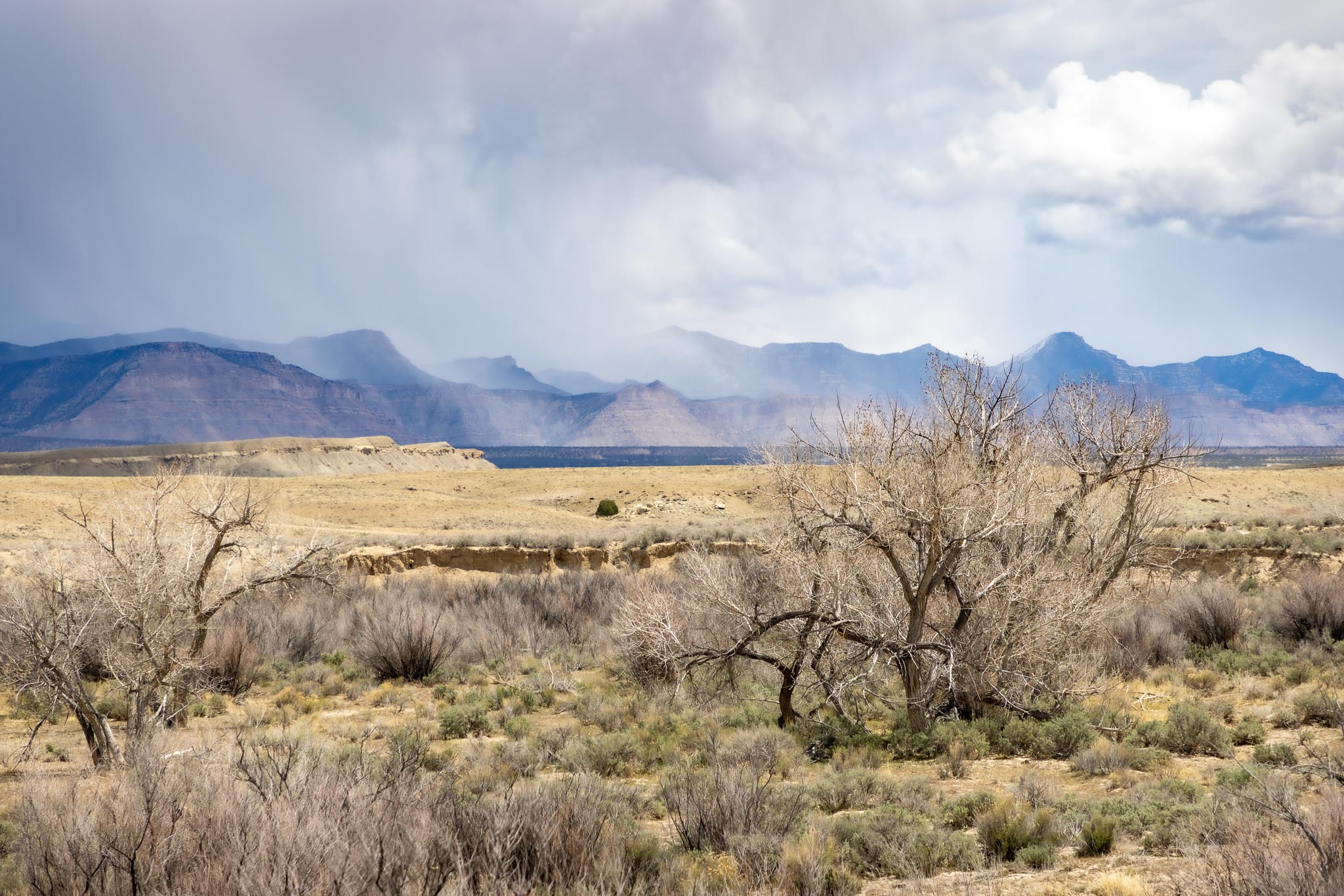
Sunrise After the Storm
Twin Towers and Eroded Boulder House, Hovenweep National Monument, Aneth UT
September 30, 2016
The light! The landscape lit by the rising sun beneath a clouded sky is pure magic!
Head over to Hovenweep National Monument for more images of this monument.
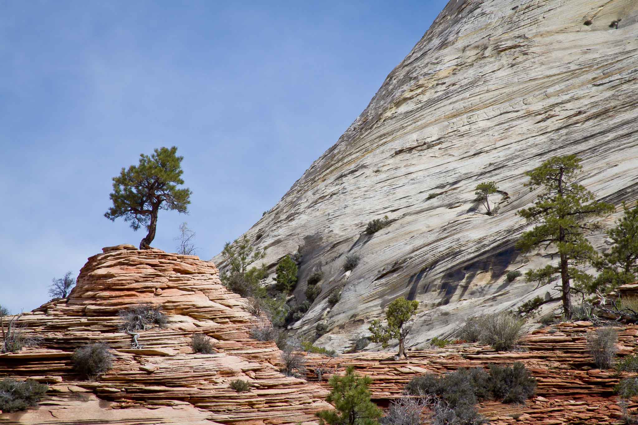
Lone Pine
Zion National Park, Springdale UT
April 11, 2011
Back in April 2011 I spent a few days at Zion National Park in Springdale UT. Climbing up out of the park, eastbound along route 9, I came upon these red and gray cliffs towering above me on the left and a pullout on the right. I pulled over, shot a few pictures, and went on my way. This one, yes, this is the one.
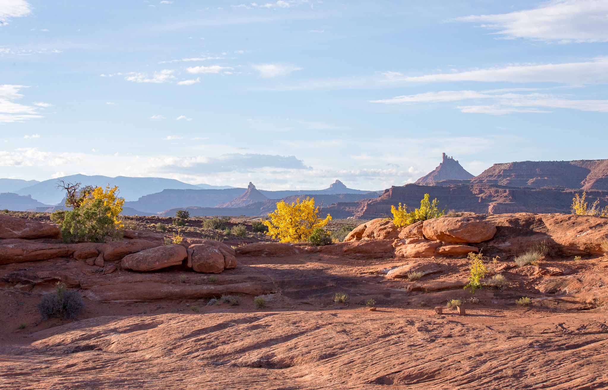
Canyon Color
Indian Creek Special Recreation Area, Canyonlands, Monticello UT
October 10, 2016
I try to spend a little time each year in this area of the BLM Indian Creek Special Recreation Area, which is within the original Bears Ears National Monument boundaries. It's a beautiful, quiet area to hike and bike, take some pictures, and relax free of the distractions of an internet connection. It saddens me this area no longer has the protections of a National Monument.
Head over to Indian Creek SRA for more images of this area.
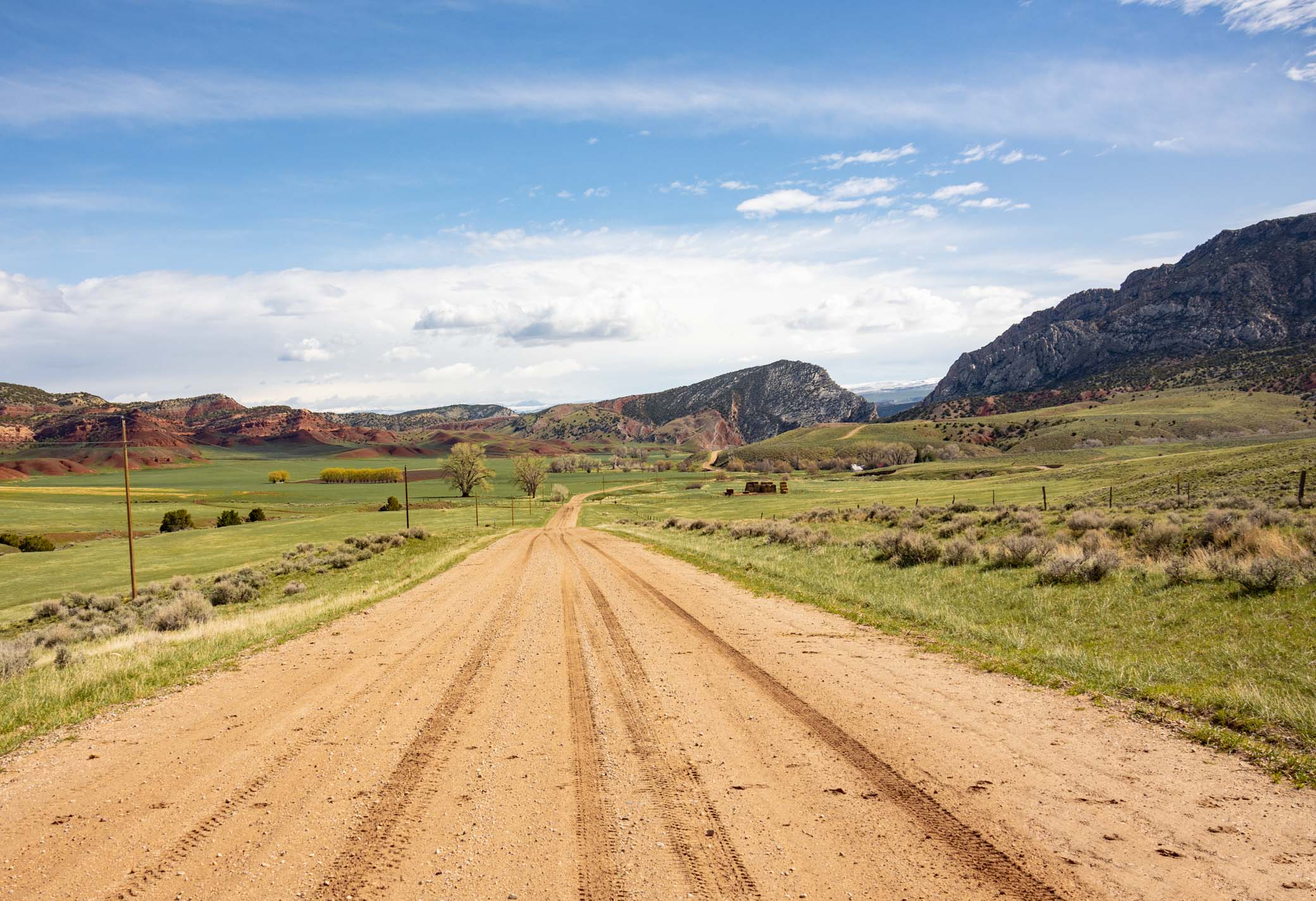
Orchard Ranch
Ten Sleep WY
May 13, 2022
I took this picture roughly about here: 43.63264° N, 107.40147° W. Look it up on your map in satelite view. I had a wild ride on that muddy dirt road coming off the divide down through the Orchard Ranch to Ten Sleep WY. It had rained a couple days before and the road was so slick this side of the divide I had to put the rig into reverse to help hold it back enough to keep the front wheels from locking and sliding off the road. If I had slid off the road I'd have been stuck there for a couple days waiting for the road to dry out (assuming I didn't slide into a ditch I couldn't get out of..:-). What an adventure! Great fun. And what a view!
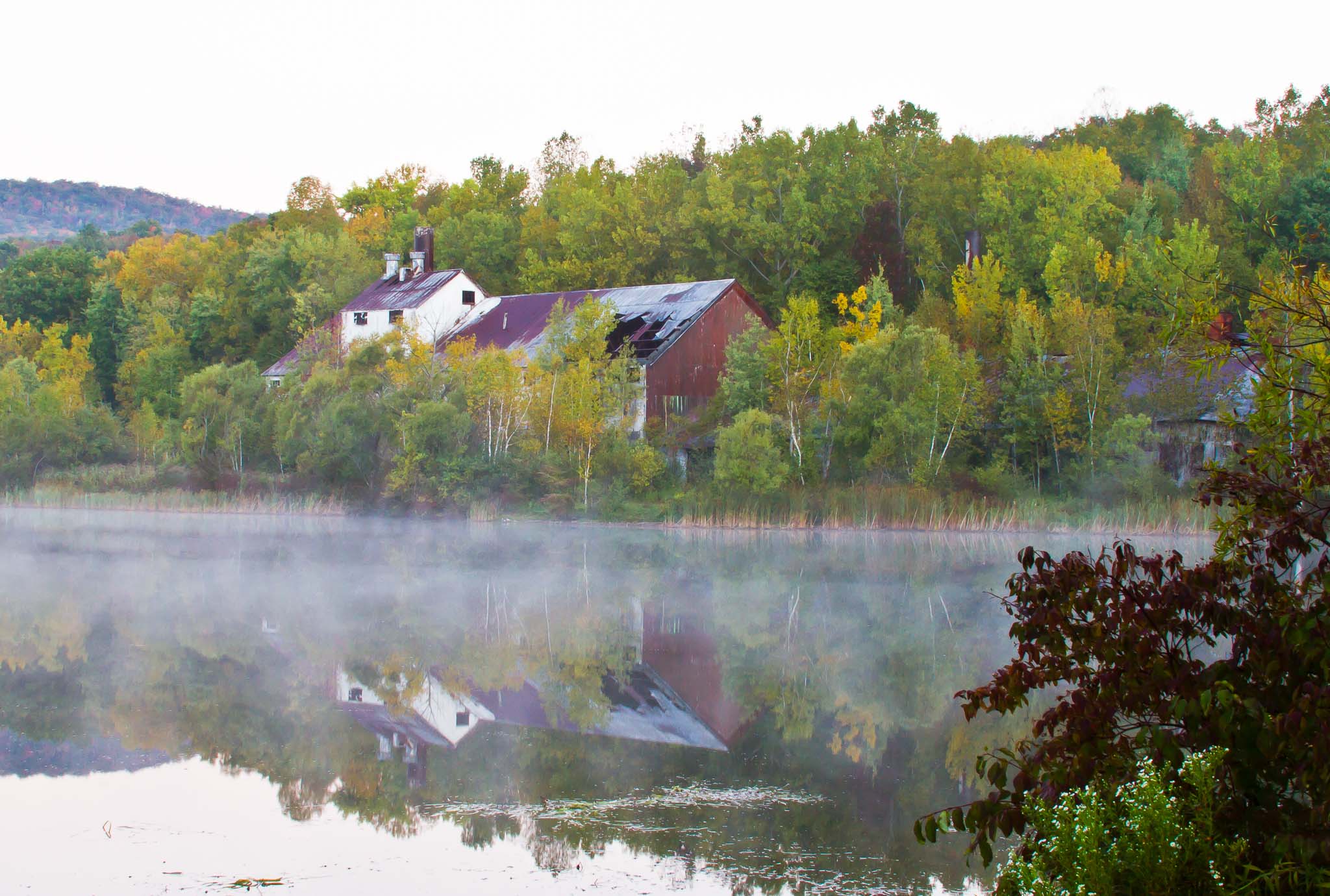
Abandoned
Farnams-Cheshire Lime Company, Cheshire Reservoir, Cheshire MA
September 20, 2010
There were several prosperous limestone quarries along this stretch of the Hoosic River between Pittsfield and Cheshire MA back in the day.
Farnams Village
The limestone mining village of Farnams is located in the foothills of Mount Greylock on the west side of Hoosac Lake, or Cheshire Reservoir. The landscape is known as an upland karst valley and contains a system of caves and limestone deposits. The village consists of twenty primary buildings laid out around the crossroads of Lanesborough, Quarry and Farnams Roads. It is an area which contains in a mountainous woodland setting a limestone quarry, originally connected to a limestone processing mill by a railway and tunnel; limestone crusher; workers' housing; office building, stockroom, carpentry shop and a small network of mining roads. Buildings and mining structures in the area date largely between 1900 and 1930.
Farnams-Cheshire Lime Company
The first quarrying to be done on this property was in the 1840s when Steven Northrup, who was principally a farmer, had a pot type kiln and began a "family quarry" for stone to build with and lime for agricultural purposes.
Steven Northrup sold the quarry and kiln in 1866 to the Farnam Brothers Alfred and Albert who were identical twins from the town who had joined the Civil War together and fought in the battle of Gettysburg. The Farnams did a good business according to a ledger account remaining from 1882-1889 averaging about $20,000/year in lime sales. The Farnams continued to add land to their holdings up to 1,400 acres, as well as constructing a building to hold the kilns which had grown in number to three. The Farnams produced "Farnams Blue Label Finishing Lime" and supplied the building trades in New York City with an extremely high quality, pure white lime for plaster. When the company went too far into debt, it was sold to Cornelius J. Curtin in 1905. Cornelius worked in New York selling the lime, while his brother Tom lived in Farnams and managed production. The business was called "The Farnam-Cheshire Lime Company", while Italians had worked under the Farnam Brothers, it was under the Curtins that laborers came mostly from a small village called Postalesio, Italy.
Workers hung from the quarry edge on ropes, drilled, and blasted the limestone with dynamite, then cut it by hand to fit into carts. Draft horses pulling the carts then followed the roads around the south side of the mountain down to the mill where the stone was processed before being sent off in barrels on the railroad whose tracks ran between the mill and the Lake. At first the Curtins built a tramway to transport the rock to the mill, but when even that was insufficient, they drilled a tunnel a half a mile long through the mountain and installed a narrow gauge railroad. The tunnel was completed in 1915/16. Hopper cars pulled by a steam engine transported the stone to the mill and the business prospered. The Curtins fired 21 upright kilns with wood. Subsequent owners used coal, coke and finally gas. A limestone crusher between the quarry and mill was erected in 1930; stone went by conveyor from crusher to sorting house, then by railroad to the mill. Air hammers used by 1941 to drill the stone, then insert dynamite. In 1950s they were mining from the surface so discontinued use of the train and tunnel and used gigantic dump trucks to transport stone to the crusher.
The mill itself was added to over a period of years between 1906 and 1929. With no heirs to run the business it was put on the market and sold in 1929. Curtins were said to have built housing for about twenty families. In addition to the workers' housing, the company owned a farm which was leased to the Rozon family who provided dairy products to the village. Their tenancy continued through company ownership by US Gypsum.
Extracted from: Farnams Village Historic District application to the National Register of Historic Places.
Dante's View
Death Valley National Park, Death Valley CA
October 21, 2014
It's a deceptive five thousand five hundred foot drop from here straight down to Badwater Basin, the lowest point in the western hemisphere. Whoaa!
Artist's Palette
Death Valley National Park, Death Valley CA
October 21, 2014
The colors on Artist's Palette are caused by the chemical weathering and hydrothermal alteration and oxidation of metals in the rock. Red, pink and yellow are from iron salts, green is from decomposing mica, and purple is from manganese.
Hastings Powers the Night
Hastings Power Plant, Hastings NE
May 8, 2011
Passing eastbound through the area I spotted the dilapidated DLD State Recreation Area park and campground east of Hastings NE and pulled in. What an interesting spot it turned out to be.
Toward Hastings stands this photogenic power plant. Behind the park is the Hastings Air Force Station, abandoned in 1968. And a mile or so east are the remains of the Hastings Naval Ammunition Depot, the largest United States World War II naval ammunitions plant.
Hastings Air Force Station
Hastings Air Force Station (ADC ID: SM-133, NORAD ID: Z-133) is a closed United States Air Force General Surveillance Radar station. It is located 5.2 miles (8.4 km) east of Hastings, Nebraska. It was closed in 1968.
Hastings Air Force Station was initially part of Phase II of the Air Defense Command Mobile Radar program. The Air Force approved this expansion of the Mobile Radar program on October 23, 1952. Radars in this network were designated “SM.”
The station became operational on 1 January 1962 with the activation of the 625th Radar Squadron (SAGE), feeding data to DC-22 at Sioux City AFS, Iowa. The radar squadron provided information 24/7 the SAGE Direction Center where it was analyzed to determine range, direction altitude speed and whether or not aircraft were friendly or hostile. The deployment of the AN/FPS-67B search radar and two AN/FPS-6 height-finder radars to Hastings marked the completion of the second phase of the mobile radar program.
The radars were operated until 1968 when Air Defense Command closed the station as part of a draw down of assets and budget reductions. Today, what was Hastings AFS is now known as the "Radar Industrial Park". It is generally abandoned, with the few buildings that remain severely deteriorated.
military.wikia.comHastings Naval Ammunition Depot
The Naval Ammunition Depot (NAD) near Hastings, Nebraska was the largest United States World War II naval munitions plant operating from 1942 to 1946 and produced over 40% of the U.S. Navy's munitions.
The former Naval Ammunition Depot (NAD) is one of Nebraska's former four major ammunition plants: the Cornhusker Ordnance Plant, the Nebraska Ordnance Plant and the Martin Bomber Plant. Its construction began in July 1942 on 49,000 acres (200 km2) and was completed in early 1943 with over 2000 buildings, bunkers, and various other types of structures. The cost of construction was over $71 million.
The navy built in this location due the proximity to the area's three railroads, the abundance of underground water, cheap natural gas and electricity, the stable work force and the distance from either coast (being beyond the range of Japanese or German bombers). At one point during World War II the facility was producing over 40% of the U.S. Navy's munitions. It manufactured 40mm shells, 16 inch projectiles, rockets, bombs, depth charges, mines and torpedoes. Production peaked in June–July 1945, when the depot employed 125 officers, 1,800 enlisted men, and 6,692 civilians.
The impact on the city of Hastings was a 40% population increase from just over 15,000 in 1940 to 22,252 at its peak during the war. By 1944, workers base wages at the depot were 74-cents an hour with time-and-a-half for overtime beyond 54 to 64 hour workweeks and thus considerably higher than the 40- to 50-cents per hour in town and maybe a dollar-a-day for a hired man on the farm. Farmers experienced a severe labor shortage, schools were overcrowded with 50-60 children, new homes were scarce.
Four accidental explosions took place during the war, of which two were officially reported. All occurred in 1944, and together resulted in the deaths of 22 people. The first accident left a crater 550 feet long, 220 feet wide, and 50 feet deep. The most severe accidental blast killed nine people and injured fifty-three on September 15, 1944. It was caused by human error while a train was being loaded. The loading depot and the train were totally destroyed. Part of the roof at a high school in Harvard, about 15 miles (24 km) east of Hastings, collapsed as a result of the explosion; injuring 10 children.
Wikipedia